
IMAGES TAKEN NEAR TO
Woodfield Hill, COULSDON, CR5 3EL
Introduction
This page details the photographs taken nearby to Woodfield Hill, CR5 3EL by members of the Geograph project.
The Geograph project started in 2005 with the aim of publishing, organising and preserving representative images for every square kilometre of Great Britain, Ireland and the Isle of Man.

There are currently over 7.5m images from over14,400 individuals and you can help contribute to the project by visiting https://www.geograph.org.uk
Image Map
Images are licensed for reuse under creativecommons.org/licenses/by-sa/2.0
Notes
- Clicking on the map will re-center to the selected point.
- The higher the marker number, the further away the image location is from the centre of the postcode.
Image Listing (18 Images Found)
Images are licensed for reuse under creativecommons.org/licenses/by-sa/2.0
Image
Details
Distance
1
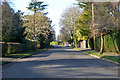
Woodfield Hill
The road has a 20 limit, quite frequently applied in these parts.
Image: © Robin Webster
Taken: 18 Jan 2020
0.01 miles
2
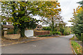
Woodfield Hill
Road shown as laid out but with only a couple of houses on the 1912-3 1:2,500 map.
Image: © Ian Capper
Taken: 27 Oct 2018
0.02 miles
3
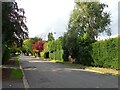
Woodfield Hill
This is the view just up from the junction with Brighton Road (A23).
Image: © Marathon
Taken: 24 Aug 2023
0.03 miles
4
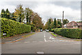
Starrock Road
Road shown as laid out but not yet developed on the 1912-3 1:2,500 map, along the line of previous footpath.
Image: © Ian Capper
Taken: 27 Oct 2018
0.08 miles
5
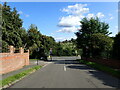
Woodfield Hill
This is the view looking down to the junction with Brighton Road (A23). Farthing Downs are on the far horizon.
Image: © Marathon
Taken: 24 Aug 2023
0.08 miles
6
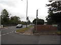
Woodfield Hill at the junction of Brighton Road
Image: © David Howard
Taken: 29 Sep 2014
0.09 miles
7
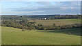
View Towards the A23
The A23 conveniently hides in the bottom of the valley, in the centre of picture.
Image: © Peter Trimming
Taken: 27 Jan 2009
0.09 miles
8
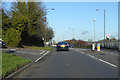
A23 Brighton Road
The left turn is Woodfield Hill, which is also the name of the bus stops on the main road.
Image: © Robin Webster
Taken: 18 Jan 2020
0.09 miles
9
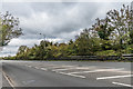
A23 Brighton Road
The A23 Brighton Road on the edge of Coulsdon. On the far right of the photo it is just possible to make out a coal tax post (no 163 on the list linked to below) in the gap in the crash barriers - see Image for a close up.
Image: © Ian Capper
Taken: 27 Oct 2018
0.12 miles
10
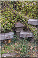
Coal tax post no 163
This coal tax post (no 163 on the list linked to below) is situated alongside the A23 Brighton Road near where it enters Coulsdon. For a wider view see Image
Very grimy from traffic, it was almost impossible to see, especially since when eventually located it was entirely covered by the Clematis behind it, which I had to move in order to reveal it. The only hint that something might be there was the gap in what is otherwise a continuous crash barrier. What made it even more difficult was that the kerbstone in the foreground marks the edge of the road itself, which being a main arterial route of London only saw occasional gaps in heavy traffic when stopped by a set of traffic lights to the north of here.
Image: © Ian Capper
Taken: 27 Oct 2018
0.13 miles