
IMAGES TAKEN NEAR TO
Brighton Road, COULSDON, CR5 3EJ
Introduction
This page details the photographs taken nearby to Brighton Road, CR5 3EJ by members of the Geograph project.
The Geograph project started in 2005 with the aim of publishing, organising and preserving representative images for every square kilometre of Great Britain, Ireland and the Isle of Man.

There are currently over 7.5m images from over14,400 individuals and you can help contribute to the project by visiting https://www.geograph.org.uk
Image Map
Images are licensed for reuse under creativecommons.org/licenses/by-sa/2.0
Notes
- Clicking on the map will re-center to the selected point.
- The higher the marker number, the further away the image location is from the centre of the postcode.
Image Listing (41 Images Found)
Images are licensed for reuse under creativecommons.org/licenses/by-sa/2.0
Image
Details
Distance
2
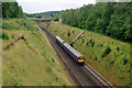
Up train on Quarry Line at Hooley
Viewed from bridge VTB2/89. The bridge visible could well be VTB2/90. It is certainly the bridge that carries Forge Bridge Lane, now blocked to vehicular traffic.
Image: © Robin Webster
Taken: 4 Aug 2010
0.05 miles
3
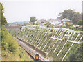
Unstable cutting, Hooley
A deep cutting on the "slow" lines from Croydon to Redhill (the fast lines are in a parallel, shallower cutting) which has obviously been heavily engineered to prevent landslides.
Image: © Stephen Craven
Taken: 18 Aug 2002
0.05 miles
4
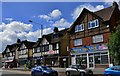
Hooley A23 road: BP Star Lane Service Station
The parade of six shops next to the filling station
Image: © Michael Garlick
Taken: 16 Sep 2013
0.06 miles
5
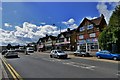
Hooley A23 road: BP Star Lane Service Station
The full parade of six shops next to the filling station
Image: © Michael Garlick
Taken: 16 Sep 2013
0.06 miles
6
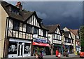
Hooley A23 road: BP Star Lane Service Station
Taken from a central reservation in the road; this is the full parade of six shops next to the BP service station.
Image: © Michael Garlick
Taken: 16 Sep 2013
0.06 miles
7
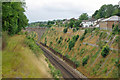
Brighton Line cutting at Hooley
This is the original 1841 route via Redhill. The steep sided cutting, made possible by the chalk, has since been further stabilised by elaborate buttressing and drainage arrangements.
Image: © Robin Webster
Taken: 4 Aug 2010
0.06 miles
8
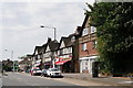
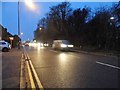
Hooley
The A23 Brighton Road.There are plans to widen the road to ease congestion.
Image: © Peter Trimming
Taken: 26 Jul 2018
0.07 miles
10
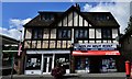
Hooley A23 road: BP Star Lane Service Station
The first two shops in the parade next to the service station.
Image: © Michael Garlick
Taken: 16 Sep 2013
0.07 miles