IMAGES TAKEN NEAR TO
Portnalls Close, COULSDON, CR5 3DB
Introduction
This page details the photographs taken nearby to Portnalls Close, CR5 3DB by members of the Geograph project.
The Geograph project started in 2005 with the aim of publishing, organising and preserving representative images for every square kilometre of Great Britain, Ireland and the Isle of Man.

There are currently over 7.5m images from over14,400 individuals and you can help contribute to the project by visiting https://www.geograph.org.uk
Image Map
Images are licensed for reuse under creativecommons.org/licenses/by-sa/2.0
Notes
- Clicking on the map will re-center to the selected point.
- The higher the marker number, the further away the image location is from the centre of the postcode.
Image Listing (48 Images Found)
Images are licensed for reuse under creativecommons.org/licenses/by-sa/2.0
Image
Details
Distance
1
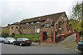
Saint Mary and Saint Shenouda Coptic Orthodox Church
On Rickman Hill, Woodmansterne.
Image: © Robin Webster
Taken: 21 Nov 2010
0.07 miles
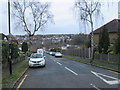
2
Portnalls Rise, Coulsdon
Portnalls Rise is a residential road in Coulsdon, on the outer fringe of south London.
Image: © Malc McDonald
Taken: 11 Jan 2020
0.07 miles
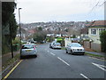
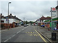
3
View down Rickman Hill
Shops on Chipstead Valley Road are at the bottom of the hill.
Image: © Robin Webster
Taken: 21 Nov 2010
0.11 miles
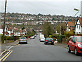
4
Vincent Road, Coulsdon
Vincent Road is a residential road in Coulsdon, on the outer fringe of south London.
Image: © Malc McDonald
Taken: 11 Jan 2020
0.12 miles
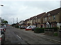
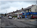
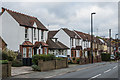
7
Chipstead Valley Road
Housing in Chipstead Valley Road. The 1912-3 1:2,500 map shows a few groups of houses in this road, at which time it was called Smithambottom Road. Full development is shown on the 1935 1:2,500 map, including these ones here. These houses were built in what was originally a gravel pit.
Image: © Ian Capper
Taken: 27 Oct 2018
0.15 miles
8

Chipstead Valley Road
Housing in Chipstead Valley Road. The 1912-3 1:2,500 map shows a few groups of houses in this road, at which time it was called Smithambottom Road. Full development is shown on the 1935 1:2,500 map, including these ones here. The area on the right was originally a gravel pit.
Image: © Ian Capper
Taken: 27 Oct 2018
0.15 miles
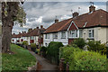
9
Chipstead Valley Road
Housing in Chipstead Valley Road. The 1912-3 1:2,500 map shows a few groups of houses in this road, at which time it was called Smithambottom Road. With the exception of the later bungalow, these houses are some of the few shown on that map. Full development is shown on the 1935 1:2,500 map.
Image: © Ian Capper
Taken: 27 Oct 2018
0.16 miles