
IMAGES TAKEN NEAR TO
Woodlands Grove, COULSDON, CR5 3AN
Introduction
This page details the photographs taken nearby to Woodlands Grove, CR5 3AN by members of the Geograph project.
The Geograph project started in 2005 with the aim of publishing, organising and preserving representative images for every square kilometre of Great Britain, Ireland and the Isle of Man.

There are currently over 7.5m images from over14,400 individuals and you can help contribute to the project by visiting https://www.geograph.org.uk
Image Map
Images are licensed for reuse under creativecommons.org/licenses/by-sa/2.0
Notes
- Clicking on the map will re-center to the selected point.
- The higher the marker number, the further away the image location is from the centre of the postcode.
Image Listing (48 Images Found)
Images are licensed for reuse under creativecommons.org/licenses/by-sa/2.0
Image
Details
Distance
2
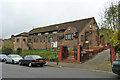
Saint Mary and Saint Shenouda Coptic Orthodox Church
On Rickman Hill, Woodmansterne.
Image: © Robin Webster
Taken: 21 Nov 2010
0.16 miles
3
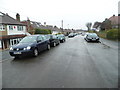
Woodlands Grove, Woodmansterne
The suburban part of Woodmansterne here is part of Coulsdon in London, which ends just behind this view and becomes the rural part in Surrey, accessible from a path here http://www.geograph.org.uk/photo/3295791
Image: © David Howard
Taken: 14 Jan 2013
0.16 miles
4

Chipstead Valley Road
Housing in Chipstead Valley Road. The 1912-3 1:2,500 map shows a few groups of houses in this road, at which time it was called Smithambottom Road. Full development is shown on the 1935 1:2,500 map, including this terrace here.
Image: © Ian Capper
Taken: 27 Oct 2018
0.17 miles
5
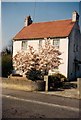
410 Chipstead Valley Road, Now Reid Close
My old house now long gone and demolished in 1993 to make way for Reid Close. It was a lovely house with a fantastic orchard at the rear of the garden which every year produced apples, damsons, pears and plenty of blackberries and in turn my granddad made superb wines from, quite strong as well.
Image: © Martin Miles
Taken: Unknown
0.17 miles
6
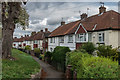
Chipstead Valley Road
Housing in Chipstead Valley Road. The 1912-3 1:2,500 map shows a few groups of houses in this road, at which time it was called Smithambottom Road. Full development is shown on the 1935 1:2,500 map, including these ones here. These houses were built in what was originally a gravel pit.
Image: © Ian Capper
Taken: 27 Oct 2018
0.17 miles
7
View from Woodstock Road, Woodmansterne
Image: © David Howard
Taken: 11 Oct 2009
0.18 miles
8

Chipstead Valley Road
Housing in Chipstead Valley Road. The 1912-3 1:2,500 map shows a few groups of houses in this road, at which time it was called Smithambottom Road. Full development is shown on the 1935 1:2,500 map, including these ones here. The area on the right was originally a gravel pit.
Image: © Ian Capper
Taken: 27 Oct 2018
0.18 miles
9
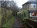
Path from Woodlands Grove, Woodmansterne
This is taken on the border of London looking towards Surrey.
Image: © David Howard
Taken: 14 Jan 2013
0.18 miles
10
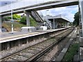
Woodmansterne Station
Woodmansterne station, on the branch to Tatenham Corner
Image: © Hywel Williams
Taken: 11 Jul 2005
0.19 miles