
IMAGES TAKEN NEAR TO
Sutton Close, CATERHAM, CR3 6FH
Introduction
This page details the photographs taken nearby to Sutton Close, CR3 6FH by members of the Geograph project.
The Geograph project started in 2005 with the aim of publishing, organising and preserving representative images for every square kilometre of Great Britain, Ireland and the Isle of Man.

There are currently over 7.5m images from over14,400 individuals and you can help contribute to the project by visiting https://www.geograph.org.uk
Image Map
Images are licensed for reuse under creativecommons.org/licenses/by-sa/2.0
Notes
- Clicking on the map will re-center to the selected point.
- The higher the marker number, the further away the image location is from the centre of the postcode.
Image Listing (15 Images Found)
Images are licensed for reuse under creativecommons.org/licenses/by-sa/2.0
Image
Details
Distance
1
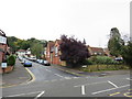
Beechwood Road, Caterham
Beechwood Road in Caterham, in Surrey. The building to the right of the road is a former school, which has now been converted to residential use.
Image: © Malc McDonald
Taken: 12 Oct 2019
0.02 miles
2
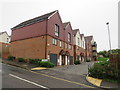
Old School Gardens, Caterham
As the name suggests, these houses in Caterham were built on the site formerly occupied by a school.
Image: © Malc McDonald
Taken: 12 Oct 2019
0.02 miles
3
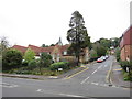
Farningham Road, Caterham
Farningham Road is a residential road in Caterham, in Surrey. The building to the left of the image is a former school which has been converted into residential use.
Image: © Malc McDonald
Taken: 12 Oct 2019
0.03 miles
4
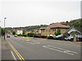
Croydon Road, Caterham
The B2208 Croydon Road heading into Caterham. This road would once have been part of the main A22, before the Caterham By-Pass was opened.
Image: © Malc McDonald
Taken: 12 Oct 2019
0.06 miles
5
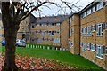
Yellow brick flats beside Croydon Road
Image: © David Martin
Taken: 21 Nov 2014
0.12 miles
6
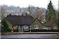
Across the rooftops of the Caterham Valley
Image: © David Martin
Taken: 21 Nov 2014
0.14 miles
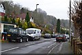
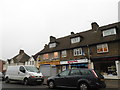
9
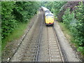
Caterham Valley railway line
The first proposals for a railway along the Caterham Valley came in 1836 with the object of building a new London to Dover line through a mile long tunnel under the North Downs. It proved too costly and the existing line via Redhill was used. Instead Caterham received a branch line, built by a private company in 1856. The original purpose was to provide a convenient method of transporting the valuable building stone from the quarries at Godstone to London. Soon though the original purpose was overtaken by wealthy Victorian commuters using the line as the Caterham Valley developed. There were early frustrations for these commuters, for example, in the London, Brighton & South Coast Railway arranging for the connecting train at Godstone Road (now Purley) station to leave one minute before the Caterham train arrived.
In this photograph from a footbridge between Stafford Road and Croydon Road an engineering train heads up the line towards Whyteleafe South, away from Caterham station. The wooded nature of much of the line can also be seen.
Image: © Marathon
Taken: 4 Jul 2012
0.23 miles
10
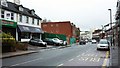
Croydon Road, Caterham
This is the B2208. The green barrier on the left indicates where the Valley pub used to be - now demolished. There are some pictures of it here http://www.pubsgalore.co.uk/pubpictures/57441/ .
Image: © Derek Harper
Taken: 14 Nov 2015
0.23 miles