IMAGES TAKEN NEAR TO
Alexanders Walk, CATERHAM, CR3 6DT
Introduction
This page details the photographs taken nearby to Alexanders Walk, CR3 6DT by members of the Geograph project.
The Geograph project started in 2005 with the aim of publishing, organising and preserving representative images for every square kilometre of Great Britain, Ireland and the Isle of Man.

There are currently over 7.5m images from over14,400 individuals and you can help contribute to the project by visiting https://www.geograph.org.uk
Image Map
Images are licensed for reuse under creativecommons.org/licenses/by-sa/2.0
Notes
- Clicking on the map will re-center to the selected point.
- The higher the marker number, the further away the image location is from the centre of the postcode.
Image Listing (17 Images Found)
Images are licensed for reuse under creativecommons.org/licenses/by-sa/2.0
Image
Details
Distance
1
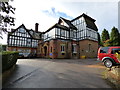
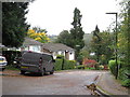
Caterham: Tupwood Gate Nursing Home
Off Tupwood Lane.
Image: © Dr Neil Clifton
Taken: 11 Oct 2014
0.02 miles
2
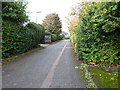
Caterham: The Copse
Looking west from Tupwood Lane. The Copse is a cul-d-sac.
Image: © Dr Neil Clifton
Taken: 11 Oct 2014
0.04 miles
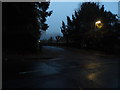
4

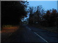
Near the top of Tupwood Lane
About to start a long descent to Caterham town centre.
Image: © Andrew Hill
Taken: 17 Nov 2009
0.11 miles
6
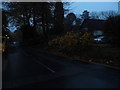
Bradenhurst Close, Caterham
Bradenhurst Close is a residential cul-de-sac in Caterham, in Surrey.
Image: © Malc McDonald
Taken: 12 Oct 2019
0.16 miles
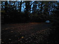
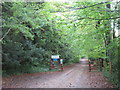
8
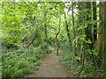
Path through woodland in Caterham
This is beyond St Katharine's Road where the path meets an active timber-felling area and turns to avoid it, passing through this woodland.
Image: © Marathon
Taken: 4 May 2023
0.18 miles
9
Tupwood Lane looking towards Grange Road
Image: © David Howard
Taken: 17 Nov 2013
0.18 miles
10
Harestone Hill, near Caterham
Harestone Hill in woodland near Caterham. Beyond this point, the road becomes a public bridleway with restricted access for motor vehicles.
Image: © Malc McDonald
Taken: 12 Oct 2019
0.19 miles