
IMAGES TAKEN NEAR TO
The Grove, CATERHAM, CR3 5QD
Introduction
This page details the photographs taken nearby to The Grove, CR3 5QD by members of the Geograph project.
The Geograph project started in 2005 with the aim of publishing, organising and preserving representative images for every square kilometre of Great Britain, Ireland and the Isle of Man.

There are currently over 7.5m images from over14,400 individuals and you can help contribute to the project by visiting https://www.geograph.org.uk
Image Map
Images are licensed for reuse under creativecommons.org/licenses/by-sa/2.0
Notes
- Clicking on the map will re-center to the selected point.
- The higher the marker number, the further away the image location is from the centre of the postcode.
Image Listing (82 Images Found)
Images are licensed for reuse under creativecommons.org/licenses/by-sa/2.0
Image
Details
Distance
1

Former married quarters, Caterham Barracks
This long terrace has access at the front for one set of dwellings, and at the back for another. They are probably flats, one above the other. For the rear view, see Image, and for the decoration of the central pediment, see Image
Image: © Robin Webster
Taken: 1 Feb 2011
0.01 miles
2

Former married quarters, Caterham Barracks - central pediment
Centrally on this long terrace is a decoration with an emblem representing the Brigade of Guards with the motto "Tria juncta in uno". Beneath is a quotation that could hardly have heartened the builders. For a view of the whole terrace, see Image
Image: © Robin Webster
Taken: 1 Feb 2011
0.01 miles
3

Former married quarters, Caterham Barracks - rear view
This long terrace has one set of dwellings entered from the front, and another from the back. The rear ones are probably upstairs flats. Their gardens are across this alley on the left. For the front, see Image
Image: © Robin Webster
Taken: 1 Feb 2011
0.02 miles
4

The Grove
Former housing from Caterham Barracks. The Barracks, which originated in 1877, were extended northwards to here in 1923.
Image: © Ian Capper
Taken: 29 Oct 2016
0.02 miles
5

Coulsdon Common - Boundary Post
City of London boundary post near Coulsdon Common
Image: © P Redz
Taken: 26 Jan 2013
0.03 miles
6

Caterham: The Grove
These are maisonettes, with 1 and 2 at the near end
Image: © Dr Neil Clifton
Taken: 28 Apr 2017
0.03 miles
7

Coulsdon Common: Coal Post
It bears the City of London coat of arms and the date, 1996
Image: © Dr Neil Clifton
Taken: 28 Apr 2017
0.03 miles
8
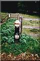
Not so old Boundary Marker in Coulsdon
Municipal Boundary Marker against the corner of a wooden fence on the northwest side of The Grove, opposite Green Lane and beside a footpath across Coulsdon Common. On the boundary of Croydon Borough and Caterham on the Hill, Surrey. In raised lettering (coat of arms) / CITY / OF / LONDON / 1996. This replaced a missing City of London Coal Tax Post. See also https://www.geograph.org.uk/photo/5961697, https://www.geograph.org.uk/photo/3313246 and https://www.geograph.org.uk/photo/5368076.
Milestone Society National ID: SY_COUCAT01pb
Image: © C Woodward
Taken: 4 Oct 2011
0.03 miles
9
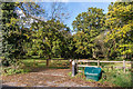
Coulsdon Common
Gate into Coulsdon Common off The Grove. Coulsdon Common is one of seven areas of open spaces in south London and Surrey owned by the City of London Corporation, known collectively as the City Commons. For a close up of the City of London Corporationpost by the gate, see Image
Image: © Ian Capper
Taken: 27 Oct 2018
0.03 miles
10
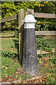
City of London Corporation post
Post with the crest of the City of London Corporation situated by a gate into Coulsdon Common off The Grove. Coulsdon Common is one of seven areas of open spaces in south London and Surrey owned by the City of London Corporation, known collectively as the City Commons. For a wider view of the entrance, see Image
Image: © Ian Capper
Taken: 27 Oct 2018
0.03 miles