
IMAGES TAKEN NEAR TO
Buxton Lane, CATERHAM, CR3 5HH
Introduction
This page details the photographs taken nearby to Buxton Lane, CR3 5HH by members of the Geograph project.
The Geograph project started in 2005 with the aim of publishing, organising and preserving representative images for every square kilometre of Great Britain, Ireland and the Isle of Man.

There are currently over 7.5m images from over14,400 individuals and you can help contribute to the project by visiting https://www.geograph.org.uk
Image Map
Images are licensed for reuse under creativecommons.org/licenses/by-sa/2.0
Notes
- Clicking on the map will re-center to the selected point.
- The higher the marker number, the further away the image location is from the centre of the postcode.
Image Listing (29 Images Found)
Images are licensed for reuse under creativecommons.org/licenses/by-sa/2.0
Image
Details
Distance
1
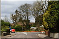
Road Junction on Buxton Lane, Kenley, Surrey
The Royal Mail van continues on Buxton Lane, towards Kenley airfield. Salmons Lane West comes in from the right. Ninehams Road is hidden, to the left.
Image: © Peter Trimming
Taken: 1 Apr 2010
0.02 miles
2
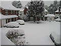
Winter in Rosebriars
Result of the heavy snowfall on 2 February 2009.
Image: © Peter Heather
Taken: 2 Feb 2009
0.04 miles
3
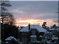
Sunset over Buxton Lane
Beautiful sunset on 7 January 2010.
Image: © Peter Heather
Taken: 7 Jan 2010
0.06 miles
4
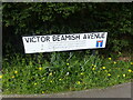
Sign for Victor Beamish Avenue
Roads named after people are not uncommon but I have never seen a road name which said who the person honoured was. This is near Kenley Airfield. His story is here - en.wikipedia.org/wiki/Victor_Beamish
Image: © Marathon
Taken: 4 May 2023
0.06 miles
5
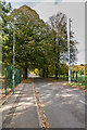
Victor Beamish Avenue
Tree lined road leading into the former RAF Kenley.
Image: © Ian Capper
Taken: 12 Oct 2018
0.07 miles
7
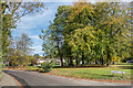
Salmons Lane
Open space on Salmons Lane near its junction with Whyteleafe Road.
Image: © Ian Capper
Taken: 12 Oct 2018
0.10 miles
8

Former building at RAF Kenley 1979
I took this photo in 1979, can anyone identify its purpose at RAF Kenley? Many such buildings at RAF Kenley have been demolished over the last few decades but one or two survive. Most recently, many new houses have been built and I was pleased to see that some of the roads have been named after pilots who flew from Kenley during WWII.
Image: © David Harvey
Taken: Unknown
0.13 miles
9
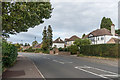
Buxton Lane
c1930s housing in Buxton Lane. Older maps name the road Buxton's Lane, and show a large house further along the lane called The Buckstones.
Image: © Ian Capper
Taken: 12 Oct 2018
0.13 miles
10
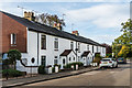
135 - 147 Buxton Lane
Late Victorian terrace, marked on the 1897 1:2,500 map as Coulsdon Cottages.
Image: © Ian Capper
Taken: 12 Oct 2018
0.15 miles