IMAGES TAKEN NEAR TO
Godstone Road, WHYTELEAFE, CR3 0EH
Introduction
This page details the photographs taken nearby to Godstone Road, CR3 0EH by members of the Geograph project.
The Geograph project started in 2005 with the aim of publishing, organising and preserving representative images for every square kilometre of Great Britain, Ireland and the Isle of Man.

There are currently over 7.5m images from over14,400 individuals and you can help contribute to the project by visiting https://www.geograph.org.uk
Image Map
Images are licensed for reuse under creativecommons.org/licenses/by-sa/2.0
Notes
- Clicking on the map will re-center to the selected point.
- The higher the marker number, the further away the image location is from the centre of the postcode.
Image Listing (92 Images Found)
Images are licensed for reuse under creativecommons.org/licenses/by-sa/2.0
Image
Details
Distance
2

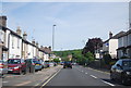
Whyteleafe: Godstone Road
Looking north, towards Purley. This is part of the A22.
Image: © Dr Neil Clifton
Taken: 1 Apr 2011
0.02 miles
3
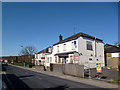
Roundabout on Godstone Road, Whyteleafe
Image: © David Howard
Taken: 26 Mar 2012
0.06 miles
5

An up train leaves Whyteleafe station
The first proposals for a railway along the Caterham Valley came in 1836 with the object of building a new London to Dover line through a mile long tunnel under the North Downs. It proved too costly and the existing line via Redhill was used. Instead Caterham received a branch line, built by Caterham Railway, a private company, and opened in 1856. The original purpose was to provide a convenient method of transporting the valuable building stone from the quarries at Godstone to London. Soon though the original purpose was overtaken by wealthy Victorian commuters using the line as the Caterham Valley developed. There were early frustrations for these commuters, for example, in the London, Brighton & South Coast Railway arranging for the connecting train at Godstone Road (now Purley) station to leave one minute before the Caterham train arrived. The Caterham branch was increased from single to double track by January 1st 1900 and Whyteleafe station was opened on the same day. A train is just leaving on its way to Kenley. Riddlesdown is on the horizon.
Image: © Marathon
Taken: 9 May 2012
0.07 miles
6
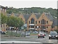
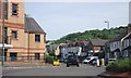
The A22 at the junction of Hillbury Road
I took this to reproduce a shot I took in 1993 once I realised I needed to double the focal length to meet the SLR I used. Here is the older one. http://www.geograph.org.uk/photo/3658223
The North Downs can be seen behind the buildings which climb above Purley and south along the A22.
Image: © David Howard
Taken: 17 Aug 2015
0.07 miles
7
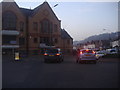
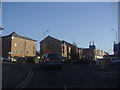
Offices on the A22 roundabout, Whyteleafe
The north downs can be seen on the right which run along the A22
Image: © David Howard
Taken: 26 Mar 2012
0.07 miles
8
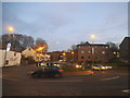
The A22 at the junction of Hillbury Road
This is a very useful junction, heading to the south coast, Kent and deepest Surrey depending which exit you take from London.
Image: © David Howard
Taken: 11 Dec 2016
0.07 miles
9
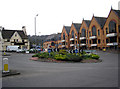
Whyteleafe: Roundabout on the A22
The A22 London to Eastbourne road (London to the right) meets Hillbury Road (behind the camera) and Whyteleafe Hill (straight ahead). The pub. seen on the left is the 'Whyteleafe Tavern'.
Image: © Dr Neil Clifton
Taken: 1 Apr 2011
0.08 miles