IMAGES TAKEN NEAR TO
Godstone Road, WHYTELEAFE, CR3 0EA
Introduction
This page details the photographs taken nearby to Godstone Road, CR3 0EA by members of the Geograph project.
The Geograph project started in 2005 with the aim of publishing, organising and preserving representative images for every square kilometre of Great Britain, Ireland and the Isle of Man.

There are currently over 7.5m images from over14,400 individuals and you can help contribute to the project by visiting https://www.geograph.org.uk
Image Map
Images are licensed for reuse under creativecommons.org/licenses/by-sa/2.0
Notes
- Clicking on the map will re-center to the selected point.
- The higher the marker number, the further away the image location is from the centre of the postcode.
Image Listing (42 Images Found)
Images are licensed for reuse under creativecommons.org/licenses/by-sa/2.0
Image
Details
Distance
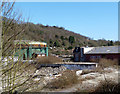
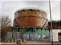
2
House and gas holder on Godstone Road
I have no idea why they would build a house next to a gas holder, but here it is. I don't know what it's holding as it's not part of a larger gas works, but from above is just next to the house in the garden.
Image: © David Howard
Taken: 15 Mar 2015
0.05 miles
3
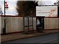
New Barn Lane Bus Shelter at Whyteleafe
Image: © tristan forward
Taken: 10 Feb 2010
0.07 miles
5
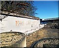
Make Cake Not War
World Cake II....hmm.....The Cakes of the Roses....maybe.....The English Civil Cake....that's more like it....The American Cake of Independence....yes!
Reader's Voice :- Shut up, Des.
Image: © Des Blenkinsopp
Taken: 2 Apr 2013
0.09 miles
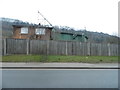
6
Panta House
On the A22 Godstone Road by the junction (right) with Old Barn Lane, which takes the London Loop westwards,
Image: © Derek Harper
Taken: 26 Apr 2022
0.10 miles
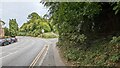
8

Bourne flood at Whyteleafe
The Caterham Bourne only flows after several weeks of heavy rain. It is purely a groundwater flood and will probably last a few more weeks. The road (A22) is closed.
Image: © Tudor Hughes
Taken: 16 Feb 2014
0.11 miles
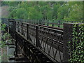
10
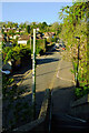
New Barn Lane, Kenley
From the footbridge over the railway line between Kenley and Whyteleafe.
Image: © Derek Harper
Taken: 26 Apr 2022
0.12 miles