IMAGES TAKEN NEAR TO
Hillcrest Road, WHYTELEAFE, CR3 0DL
Introduction
This page details the photographs taken nearby to Hillcrest Road, CR3 0DL by members of the Geograph project.
The Geograph project started in 2005 with the aim of publishing, organising and preserving representative images for every square kilometre of Great Britain, Ireland and the Isle of Man.

There are currently over 7.5m images from over14,400 individuals and you can help contribute to the project by visiting https://www.geograph.org.uk
Image Map
Images are licensed for reuse under creativecommons.org/licenses/by-sa/2.0
Notes
- Clicking on the map will re-center to the selected point.
- The higher the marker number, the further away the image location is from the centre of the postcode.
Image Listing (45 Images Found)
Images are licensed for reuse under creativecommons.org/licenses/by-sa/2.0
Image
Details
Distance
1
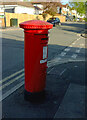
Postbox, Beverley Road
George V priority postbox CR3 338 can be glimpsed lurking in the shadows in Image
Image: © Derek Harper
Taken: 26 Apr 2022
0.04 miles
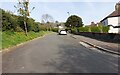
2
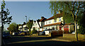
Crossroads, Beverley Road
Beverley Road crosses Hillcrest Road. Are we in Kenley or Whyteleafe here?
Image: © Derek Harper
Taken: 26 Apr 2022
0.04 miles
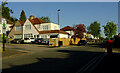
3

Bourne flood at Whyteleafe
The Caterham Bourne only flows after several weeks of heavy rain. It is purely a groundwater flood and will probably last a few more weeks. The road (A22) is closed.
Image: © Tudor Hughes
Taken: 16 Feb 2014
0.10 miles
4
Houses on Beverley Road, Whyteleafe
Semis on the west side of the road.
Image: © Derek Harper
Taken: 26 Apr 2022
0.12 miles
5

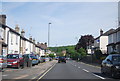
Mosslea Road, Whyteleafe
Dropping down from its junction with Hornchurch Hill, and followed by the Tandridge Border Path.
Image: © Derek Harper
Taken: 26 Apr 2022
0.14 miles
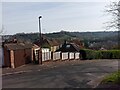
7
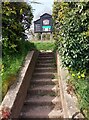
Entrance to Kenley Common from Hilltop Road
Image: © Bartolo Creations
Taken: 17 Apr 2022
0.16 miles
8
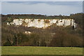
View Towards Riddlesdown Quarry, Surrey
Riddlesdown Quarry; formerly known as Rose & Crown Pit, after the pub which used to stand opposite the entrance, is the chalk cliff in the centre of picture. Photographed from the edge of Kenley Common, before it drops sharply into the valley which carries the A22 road, between Purley and Caterham.
Image: © Peter Trimming
Taken: 1 Apr 2010
0.16 miles