
IMAGES TAKEN NEAR TO
Station Approach, WHYTELEAFE, CR3 0AZ
Introduction
This page details the photographs taken nearby to Station Approach, CR3 0AZ by members of the Geograph project.
The Geograph project started in 2005 with the aim of publishing, organising and preserving representative images for every square kilometre of Great Britain, Ireland and the Isle of Man.

There are currently over 7.5m images from over14,400 individuals and you can help contribute to the project by visiting https://www.geograph.org.uk
Image Map
Images are licensed for reuse under creativecommons.org/licenses/by-sa/2.0
Notes
- Clicking on the map will re-center to the selected point.
- The higher the marker number, the further away the image location is from the centre of the postcode.
Image Listing (102 Images Found)
Images are licensed for reuse under creativecommons.org/licenses/by-sa/2.0
Image
Details
Distance
1
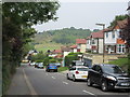
Westhall Road
This long road leads down from Limpsfield Road, through Warlingham.
This is the last short section heading to Hilbury Road.
Whyteleafe Recreational Ground is in the background.
Image: © David Anstiss
Taken: 6 Sep 2014
0.03 miles
2
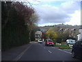
Westhall Road looking towards Hillbury Road
The new houses at the end were built around 2010. The North Downs are behind.
Image: © David Howard
Taken: 15 Apr 2012
0.04 miles
3
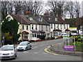
Whyteleafe: Terrace houses at the bottom of Hillbury Road
Image: © Dr Neil Clifton
Taken: 1 Apr 2011
0.04 miles
4
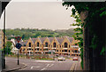
The A22 from under the railway bridge on Hillbury Road c1993
A nice view of the North Downs
Image: © David Howard
Taken: Unknown
0.04 miles
5
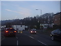
Godstone Road, Whyteleafe
Hillbury Road is on the right and the North Downs beyond
Image: © David Howard
Taken: 26 Mar 2012
0.05 miles
6
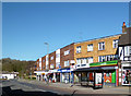
Bus Stop by the Curry House
A mis-matched two unit infill in this terrace of shop houses.
Image: © Des Blenkinsopp
Taken: 2 Apr 2013
0.05 miles
7
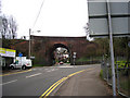
Whyteleafe: Railway bridge over Hillbury Road
The bridge carries the ex-LBSC and SER joint railway from Croydon to Oxted.
Image: © Dr Neil Clifton
Taken: 1 Apr 2011
0.05 miles
8
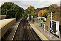
Upper Warlingham Railway Station
Looking in the Croydon (up) direction.
Image: © Peter Trimming
Taken: 20 Oct 2015
0.05 miles
9
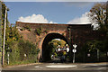
Bridge at Whyteleafe
Located just north of Upper Warlingham station, on the line which runs to East Grinstead and Uckfield.
Image: © Peter Trimming
Taken: 20 Oct 2015
0.05 miles
10
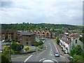
Hillbury Road, B270, enters Whyteleaf
Viewed from the railway north of Upper Warlingham Station.
Image: © Russel Wills
Taken: 17 May 2014
0.05 miles