
IMAGES TAKEN NEAR TO
Salmons Lane, WHYTELEAFE, CR3 0AN
Introduction
This page details the photographs taken nearby to Salmons Lane, CR3 0AN by members of the Geograph project.
The Geograph project started in 2005 with the aim of publishing, organising and preserving representative images for every square kilometre of Great Britain, Ireland and the Isle of Man.

There are currently over 7.5m images from over14,400 individuals and you can help contribute to the project by visiting https://www.geograph.org.uk
Image Map
Images are licensed for reuse under creativecommons.org/licenses/by-sa/2.0
Notes
- Clicking on the map will re-center to the selected point.
- The higher the marker number, the further away the image location is from the centre of the postcode.
Image Listing (46 Images Found)
Images are licensed for reuse under creativecommons.org/licenses/by-sa/2.0
Image
Details
Distance
1
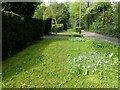
Salmons Lane
This is looking downhill towards Whyteleafe South station.
Image: © Marathon
Taken: 4 May 2023
0.04 miles
2
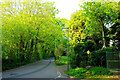
Salmons Lane
At the junction with Church Road (right).
Image: © Derek Harper
Taken: 26 Apr 2022
0.06 miles
3
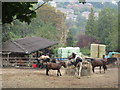
Stables in the City
This stables along Church Road is close to the London suburb of Whyteleafe.
Along the road was another stables and several paddocks plus an allotment site.
Image: © David Anstiss
Taken: 6 Sep 2014
0.08 miles
4
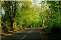
Church Road, Whyteleafe
Looking right from Image
Image: © Derek Harper
Taken: 26 Apr 2022
0.09 miles
5
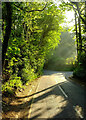
Salmons Lane
Morning sun on the lane as it drops past Portley Wood Road.
Image: © Derek Harper
Taken: 26 Apr 2022
0.09 miles
6
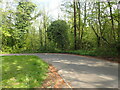
Salmons Lane
This is looking downhill towards Whyteleafe South station. There is extensive woodland on the opposite side of the road.
Image: © Marathon
Taken: 4 May 2023
0.10 miles
7
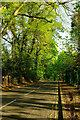
Church Road, Whyteleafe
Taken further along Image The road, mapped as a route with public access, runs parallel to the A22 Godstone Road but some way up the western valley side.
Image: © Derek Harper
Taken: 26 Apr 2022
0.11 miles
8
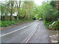
Salmons Lane, Whyteleafe
The roads either side of the Caterham Valley rise up quite steeply. This is Salmons Lane which leads from Godstone Road (A22) across a level crossing on the south side of Whyteleafe South station and then up the side of the valley, as seen here.
Image: © Marathon
Taken: 9 May 2012
0.15 miles
9
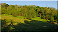
Hillside below Blize Wood
Looking left from Church Road Image
Image: © Derek Harper
Taken: 26 Apr 2022
0.15 miles
10
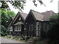
Crossways cottage
This small cottage on the junction of The Avenue and Salmons Lane (unseen on the right), has an unusual timber-log facing.
Image: © David Anstiss
Taken: 6 Sep 2014
0.15 miles