IMAGES TAKEN NEAR TO
Hazelwood Grove, SOUTH CROYDON, CR2 9DU
Introduction
This page details the photographs taken nearby to Hazelwood Grove, CR2 9DU by members of the Geograph project.
The Geograph project started in 2005 with the aim of publishing, organising and preserving representative images for every square kilometre of Great Britain, Ireland and the Isle of Man.

There are currently over 7.5m images from over14,400 individuals and you can help contribute to the project by visiting https://www.geograph.org.uk
Image Map
Images are licensed for reuse under creativecommons.org/licenses/by-sa/2.0
Notes
- Clicking on the map will re-center to the selected point.
- The higher the marker number, the further away the image location is from the centre of the postcode.
Image Listing (13 Images Found)
Images are licensed for reuse under creativecommons.org/licenses/by-sa/2.0
Image
Details
Distance
1
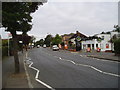
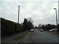
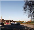
B 269 at Limpsfield Road, Sanderstead, Surrey
Looking north: Majestic Wine Warehouse on the right
Image: © Dr Neil Clifton
Taken: 20 Sep 2005
0.10 miles
2
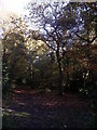
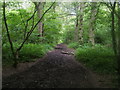
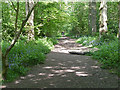
Path in King's Wood
One of the many straight tracks in the square (former hunting) wood.
Image: © David Anstiss
Taken: 13 Nov 2011
0.10 miles
3
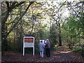
King's Wood, Sanderstead
A path leads from Lime Tree Avenue into the large square woodland.
Part of an ancient beater's track.
The information board shows a map of the wood and features in the wood.
Image: © David Anstiss
Taken: 13 Nov 2011
0.11 miles
5
King's Wood
Path entering King's Wood heading to Kingswood lane
Image: © Shaun Ferguson
Taken: 26 Jun 2012
0.15 miles
6
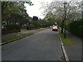
Kings Wood Sports Pavilion
At the end of Lime Meadow Avenue.
Image: © David Anstiss
Taken: 13 Nov 2011
0.16 miles
7
King's Wood, Sanderstead (2)
A small semi-open patch of land between houses on Orchard Road and the wood-proper.
Image: © Stephen Richards
Taken: Unknown
0.16 miles
9
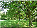
King's Wood, Sanderstead (1)
A mixed wood, covering around 150 acres.
Image: © Stephen Richards
Taken: Unknown
0.18 miles
10
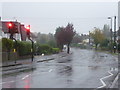
Limpsfield Road in the rain
This was a thoroughly wet and miserable Sunday afternoon. Sensible people were probably indoors rather than standing at the side of a busy road.
Image: © Marathon
Taken: 21 Oct 2012
0.19 miles