IMAGES TAKEN NEAR TO
Limpsfield Road, SOUTH CROYDON, CR2 9DJ
Introduction
This page details the photographs taken nearby to Limpsfield Road, CR2 9DJ by members of the Geograph project.
The Geograph project started in 2005 with the aim of publishing, organising and preserving representative images for every square kilometre of Great Britain, Ireland and the Isle of Man.

There are currently over 7.5m images from over14,400 individuals and you can help contribute to the project by visiting https://www.geograph.org.uk
Image Map
Images are licensed for reuse under creativecommons.org/licenses/by-sa/2.0
Notes
- Clicking on the map will re-center to the selected point.
- The higher the marker number, the further away the image location is from the centre of the postcode.
Image Listing (49 Images Found)
Images are licensed for reuse under creativecommons.org/licenses/by-sa/2.0
Image
Details
Distance
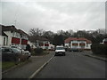
2
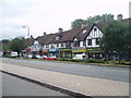
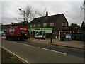
Hamsey Green
The parade of shops at Hamsey Green
Image: © Nigel Freeman
Taken: 3 Jul 2005
0.07 miles
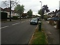
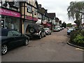
9
Co-op Supermarket, Shops, Limpsfield Road, Sanderstead
Image: © Stacey Harris
Taken: 3 May 2010
0.16 miles
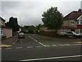
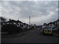
10
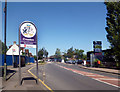
Coming into Croydon
The border with Greater London here. Surrey county is behind me.
Image: © Des Blenkinsopp
Taken: 1 Aug 2013
0.16 miles