IMAGES TAKEN NEAR TO
The Avenue, COLCHESTER, CO7 9AQ
Introduction
This page details the photographs taken nearby to The Avenue, CO7 9AQ by members of the Geograph project.
The Geograph project started in 2005 with the aim of publishing, organising and preserving representative images for every square kilometre of Great Britain, Ireland and the Isle of Man.

There are currently over 7.5m images from over14,400 individuals and you can help contribute to the project by visiting https://www.geograph.org.uk
Image Map
Images are licensed for reuse under creativecommons.org/licenses/by-sa/2.0
Notes
- Clicking on the map will re-center to the selected point.
- The higher the marker number, the further away the image location is from the centre of the postcode.
Image Listing (61 Images Found)
Images are licensed for reuse under creativecommons.org/licenses/by-sa/2.0
Image
Details
Distance
1
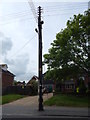
Telegraph pole, The Avenue, Wivenhoe
Opposite the bus stop Image
Image: © Hamish Griffin
Taken: 28 Apr 2014
0.02 miles
2
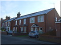
The Avenue (B1028), Wivenhoe
Looking north.
Image: © JThomas
Taken: 27 Apr 2017
0.02 miles
3
Tree opposite bus stop
Opposite the Wivenhoe, opposite Rosabell Avenue bus stop Image
Image: © Hamish Griffin
Taken: 28 Apr 2014
0.02 miles
4
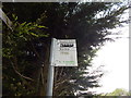
Wivenhoe, opposite Rosabell Avenue bus stop sign
See Image for an overview of the bus stop.
Image: © Hamish Griffin
Taken: 28 Apr 2014
0.02 miles
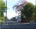
5
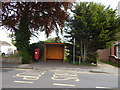
Wivenhoe, opposite Rosabell Avenue bus stop
On The Avenue (B1028).
Image: © Hamish Griffin
Taken: 28 Apr 2014
0.03 miles
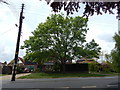
6
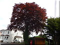
Copper Beech tree
At Wivenhoe, opposite Rosabell Avenue bus stop.
Image: © Hamish Griffin
Taken: 28 Apr 2014
0.03 miles
7
Oakwood Grove sign
Above the Palmer Gardens sign Image off the B1028 (High Street/The Avenue).
Image: © Hamish Griffin
Taken: 28 Apr 2014
0.04 miles
8
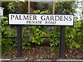
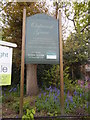
Palmer Gardens sign
See http://www.geograph.org.uk/photo/3986538 for the road itself.
Image: © Hamish Griffin
Taken: 28 Apr 2014
0.04 miles
9
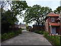
Palmer Gardens, Wivenhoe
I struggled to locate this as Google Maps only has Palmer Gardens, Barnet, London. This is a new housing development and is marked as a private road, which probably explains why it's not on Google Maps. However many "private" roads with names are still shown on maps, which probably shows that it is simply too new.
Image: © Hamish Griffin
Taken: 28 Apr 2014
0.04 miles