IMAGES TAKEN NEAR TO
Rectory Road, COLCHESTER, CO7 7JB
Introduction
This page details the photographs taken nearby to Rectory Road, CO7 7JB by members of the Geograph project.
The Geograph project started in 2005 with the aim of publishing, organising and preserving representative images for every square kilometre of Great Britain, Ireland and the Isle of Man.

There are currently over 7.5m images from over14,400 individuals and you can help contribute to the project by visiting https://www.geograph.org.uk
Image Map
Images are licensed for reuse under creativecommons.org/licenses/by-sa/2.0
Notes
- Clicking on the map will re-center to the selected point.
- The higher the marker number, the further away the image location is from the centre of the postcode.
Image Listing (7 Images Found)
Images are licensed for reuse under creativecommons.org/licenses/by-sa/2.0
Image
Details
Distance

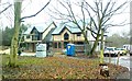
6

Great Bromley Village Hall
in Parsons Hill
Image: © Roger W Haworth
Taken: 15 Feb 2006
0.23 miles
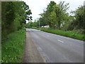
7
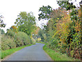
Mary Lane North
Presumably the 'North' has been tacked on because the continuous lane was severed when the A120 was built.
Image: © Robin Webster
Taken: 30 Oct 2016
0.23 miles