IMAGES TAKEN NEAR TO
Edies Lane, COLCHESTER, CO6 4PA
Introduction
This page details the photographs taken nearby to Edies Lane, CO6 4PA by members of the Geograph project.
The Geograph project started in 2005 with the aim of publishing, organising and preserving representative images for every square kilometre of Great Britain, Ireland and the Isle of Man.

There are currently over 7.5m images from over14,400 individuals and you can help contribute to the project by visiting https://www.geograph.org.uk
Image Map
Images are licensed for reuse under creativecommons.org/licenses/by-sa/2.0
Notes
- Clicking on the map will re-center to the selected point.
- The higher the marker number, the further away the image location is from the centre of the postcode.
Image Listing (27 Images Found)
Images are licensed for reuse under creativecommons.org/licenses/by-sa/2.0
Image
Details
Distance
1
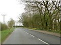
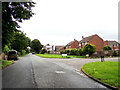
The approach to the A134 on High Road, Leavenheath
Image: © Robert Edwards
Taken: 1 Apr 2011
0.18 miles
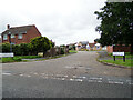
2
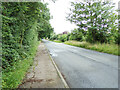
High Road, Leavenheath
At the junction with the A134 Honey Tye
Road No.U8611
Image: © Geographer
Taken: 10 Jul 2021
0.18 miles
3
High Road, Leavenheath
At the junction with the A134 Honey Tye
Road No.U8611
Image: © Geographer
Taken: 10 Jul 2021
0.19 miles
4
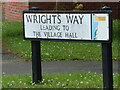
Wrights Way sign
On Wrights Way at the junction with High Road
Road No.U8612
Image: © Geographer
Taken: 10 Jul 2021
0.20 miles
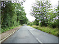
5
High Road, Leavenheath
At the junction with Wrights Way
Road No.U8611
Image: © Geographer
Taken: 10 Jul 2021
0.20 miles
6
Wrights Way, Leavenheath
At the junction with High Road
Road No.U8612
Image: © Geographer
Taken: 10 Jul 2021
0.20 miles
7
Wrights Way, Leavenheath
At the junction with High Road
Road No.U8612
Image: © Geographer
Taken: 10 Jul 2021
0.20 miles
8
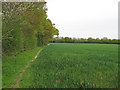
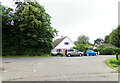
Arable field boundary, near Kingsland Lane, Leavenheath
Image: © Roger Jones
Taken: 4 May 2015
0.22 miles
9
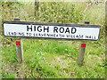
High Road sign
On High Road at the junction with the A134 Honey Tye
Road No.U8611
Image: © Geographer
Taken: 10 Jul 2021
0.22 miles
10
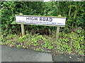
High Road sign
On High Road at the junction with the A134 Honey Tye
Road No.U8611
Image: © Geographer
Taken: 10 Jul 2021
0.22 miles