IMAGES TAKEN NEAR TO
Colchester Road, COLCHESTER, CO6 2AF
Introduction
This page details the photographs taken nearby to Colchester Road, CO6 2AF by members of the Geograph project.
The Geograph project started in 2005 with the aim of publishing, organising and preserving representative images for every square kilometre of Great Britain, Ireland and the Isle of Man.

There are currently over 7.5m images from over14,400 individuals and you can help contribute to the project by visiting https://www.geograph.org.uk
Image Map
Images are licensed for reuse under creativecommons.org/licenses/by-sa/2.0
Notes
- Clicking on the map will re-center to the selected point.
- The higher the marker number, the further away the image location is from the centre of the postcode.
Image Listing (11 Images Found)
Images are licensed for reuse under creativecommons.org/licenses/by-sa/2.0
Image
Details
Distance
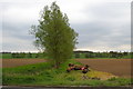
1
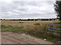
Farmland off the A1124 Colchester Road
Near Braeburn Farm
Image: © Geographer
Taken: 18 Aug 2018
0.08 miles
2
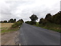
A1124 Colchester Road, Chappel
Looking towards Broom House Corner & at the entrance to Braeburn Farm
Image: © Geographer
Taken: 18 Aug 2018
0.10 miles
3
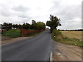
A1124 Colchester Road, Chappel
At the entrance to Braeburn Farm
Image: © Geographer
Taken: 18 Aug 2018
0.10 miles
4
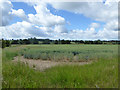
Wheat field, Colne Valley
Between the A1124 and the river.
Image: © Robin Webster
Taken: 2 Jul 2016
0.10 miles
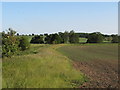
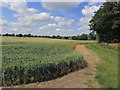
5
South from the A1124
This stand of trees follows the line of a field drain opposite Braeburn Farm on the A1124 Halsted Rd
Image: © Glyn Baker
Taken: 30 Apr 2006
0.11 miles
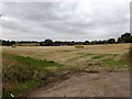
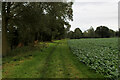
6
Arable field margin, south of Colchester Road, Wakes Colne
Image: © Roger Jones
Taken: 7 Jun 2015
0.11 miles
7
Farmland off the A1124 Colchester Road
Near Braeburn Farm
Image: © Geographer
Taken: 18 Aug 2018
0.11 miles
8
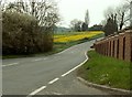
Part of the A1124, heading towards Wakes Colne
Image: © Robert Edwards
Taken: 21 Apr 2008
0.13 miles
9
On the Essex Way beside the R Colne, W of Fordstreet
Image: © Colin Park
Taken: 6 Jul 2015
0.18 miles
10
Essex Way beside the River Colne
The river is hidden by the trees, while the trail follows the grass strip beside the field crops
Image: © Chris Heaton
Taken: 14 Oct 2020
0.19 miles