IMAGES TAKEN NEAR TO
Market End, COLCHESTER, CO6 1TP
Introduction
This page details the photographs taken nearby to Market End, CO6 1TP by members of the Geograph project.
The Geograph project started in 2005 with the aim of publishing, organising and preserving representative images for every square kilometre of Great Britain, Ireland and the Isle of Man.

There are currently over 7.5m images from over14,400 individuals and you can help contribute to the project by visiting https://www.geograph.org.uk
Image Map (Loading...)


Getting Data...Please wait
Leaflet Map data © OpenStreetMap
Images are licensed for reuse under creativecommons.org/licenses/by-sa/2.0
Notes
- Clicking on the map will re-center to the selected point.
- The higher the marker number, the further away the image location is from the centre of the postcode.
Image Listing (123 Images Found)
Images are licensed for reuse under creativecommons.org/licenses/by-sa/2.0
Image
Details
Distance
1
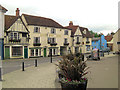
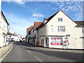
White Hart Hotel
English Heritage list this hotel as 3 separate buildings. From left to right in the photo English Heritage Building ID: 116168 is a Grade II* house originating in the 15th C. Next to it, the main structure is also 15th C. with English Heritage Building ID: 116169 but it has been altered in the 18th & 20th C. Lastly , on the right, English Heritage Building ID: 116170 is awarded to another 15th C. building extended in the next century and altered in the 19th C.
Image: © Stuart Logan
Taken: 23 Jun 2013
0.01 miles
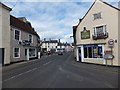
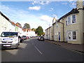
5
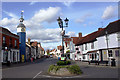
B1024 East Street, Coggeshall
At the junction with the B1024 Bridge Street & West Street
Image: © Geographer
Taken: 5 Oct 2019
0.03 miles
6
B1024 East Street, Coggeshall
At the junction with Church Street
Image: © Geographer
Taken: 5 Oct 2019
0.03 miles
7
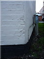
OS benchmark - Coggeshall, 2 Bridge Street
The partially obscured remains of an OS cutmark on the brick wall of the first house on Bridge Street; it was originally levelled at 29.26m above Ordnance Datum Newlyn.
Image: © Richard Law
Taken: 6 Apr 2016
0.03 miles
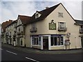
8
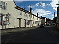
B1024 Bridge Street, Coggeshall
At the junction with the B1024 East Street & West Street
Image: © Geographer
Taken: 5 Oct 2019
0.03 miles
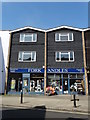
9
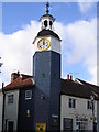
The Clockhouse Tearoom
Town Clock built in 1887. The clockhouse has been used as a school for poor children.
Image: © Angela Tuff
Taken: 15 Feb 2006
0.03 miles
10
Stoneham Street, Coggeshall
Not much in largely unspoilt Coggeshall resembles the building either side of it!
Image: © David Kemp
Taken: 12 Oct 2017
0.04 miles