IMAGES TAKEN NEAR TO
Colne Road, COLCHESTER, CO6 1AR
Introduction
This page details the photographs taken nearby to Colne Road, CO6 1AR by members of the Geograph project.
The Geograph project started in 2005 with the aim of publishing, organising and preserving representative images for every square kilometre of Great Britain, Ireland and the Isle of Man.

There are currently over 7.5m images from over14,400 individuals and you can help contribute to the project by visiting https://www.geograph.org.uk
Image Map
Images are licensed for reuse under creativecommons.org/licenses/by-sa/2.0
Notes
- Clicking on the map will re-center to the selected point.
- The higher the marker number, the further away the image location is from the centre of the postcode.
Image Listing (12 Images Found)
Images are licensed for reuse under creativecommons.org/licenses/by-sa/2.0
Image
Details
Distance
1
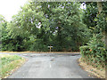
America Road, Earls Colne
At the junction with Tey Road
Image: © Geographer
Taken: 29 Jul 2018
0.14 miles
2
America Road, Earls Colne
At the junction with Tey Road
Image: © Geographer
Taken: 29 Jul 2018
0.14 miles
3

Signpost on Tey Road
At the junction with America Road
Image: © Geographer
Taken: 29 Jul 2018
0.14 miles
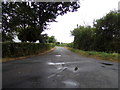
4
Tey Road, Earls Colne
At the junction with America Road
Image: © Geographer
Taken: 29 Jul 2018
0.14 miles
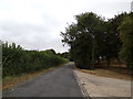
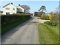
5
Tey Road, Earls Colne
At the junction with America Road
Road No.U3099
Image: © Geographer
Taken: 29 Jul 2018
0.16 miles
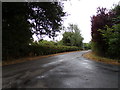
6
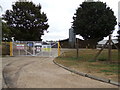
Entrance to Padleys Farm Poultry Houses
Off America Road
Image: © Geographer
Taken: 29 Jul 2018
0.16 miles
7
America Road, Earls Colne
At the entrance to Padleys Farm Poultry Houses
Image: © Geographer
Taken: 29 Jul 2018
0.16 miles
8
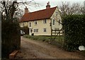
Old house known as Cucumber Hall
According to the 1940s O/S map, this was once the farmhouse of Burnthouse Farm.
Image: © Robert Edwards
Taken: 28 Dec 2006
0.21 miles
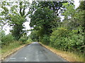
9
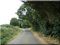
America Road, Earls Colne
Near Padleys Farm
Image: © Geographer
Taken: 29 Jul 2018
0.23 miles
10
The farmhouse at Lambert?s Farm, Lambert?s Lane
The outbuildings lie further along the lane.
Image: © John Baker
Taken: 29 Mar 2014
0.24 miles