IMAGES TAKEN NEAR TO
London Road, COLCHESTER, CO5 9EW
Introduction
This page details the photographs taken nearby to London Road, CO5 9EW by members of the Geograph project.
The Geograph project started in 2005 with the aim of publishing, organising and preserving representative images for every square kilometre of Great Britain, Ireland and the Isle of Man.

There are currently over 7.5m images from over14,400 individuals and you can help contribute to the project by visiting https://www.geograph.org.uk
Image Map (Loading...)


Getting Data...Please wait
Leaflet Map data © OpenStreetMap
Images are licensed for reuse under creativecommons.org/licenses/by-sa/2.0
Notes
- Clicking on the map will re-center to the selected point.
- The higher the marker number, the further away the image location is from the centre of the postcode.
Image Listing (36 Images Found)
Images are licensed for reuse under creativecommons.org/licenses/by-sa/2.0
Image
Details
Distance
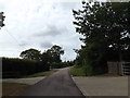
5
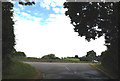
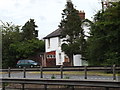
Lane at the junction with the A12 London Road
Image: © Geographer
Taken: 28 Jun 2015
0.07 miles
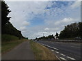
6
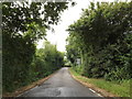
Lane off the A12 London Road
Near Hill House Farm & The Lodge
Image: © Geographer
Taken: 28 Jun 2015
0.07 miles
7
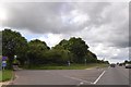
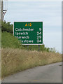
Access road to farm from A12
Hill House Farm is between the A12 and railway line and access is from this unsigned cul-de-sac
Image: © David Smith
Taken: 30 May 2017
0.07 miles
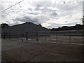
8
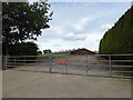
Entrance to the Poultry House
Near The Lodge
Image: © Geographer
Taken: 28 Jun 2015
0.07 miles
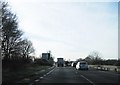
9
Lane off the A12 London Road
Near Hill House Farm & The Lodge
Image: © Geographer
Taken: 28 Jun 2015
0.08 miles
10
Entrance to the Poultry Houses
Near Orchard Barn
Image: © Geographer
Taken: 28 Jun 2015
0.13 miles