IMAGES TAKEN NEAR TO
Hillview Close, COLCHESTER, CO5 7HS
Introduction
This page details the photographs taken nearby to Hillview Close, CO5 7HS by members of the Geograph project.
The Geograph project started in 2005 with the aim of publishing, organising and preserving representative images for every square kilometre of Great Britain, Ireland and the Isle of Man.

There are currently over 7.5m images from over14,400 individuals and you can help contribute to the project by visiting https://www.geograph.org.uk
Image Map
Images are licensed for reuse under creativecommons.org/licenses/by-sa/2.0
Notes
- Clicking on the map will re-center to the selected point.
- The higher the marker number, the further away the image location is from the centre of the postcode.
Image Listing (60 Images Found)
Images are licensed for reuse under creativecommons.org/licenses/by-sa/2.0
Image
Details
Distance
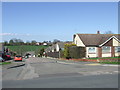
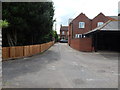
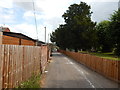
2
View north from Hill View Close, Rowhedge
Image: © Robin Webster
Taken: 28 Nov 2017
0.10 miles
3
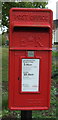
Elizabeth II postbox on Rectory Road, Rowhedge
Postbox No. CO5 259.
See Image] for context.
Image: © JThomas
Taken: 27 Apr 2017
0.16 miles
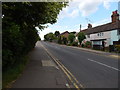
4
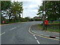
Rectory Road, Rowhedge
Showing position of Postbox No. CO5 259.
See Image] for postbox.
Image: © JThomas
Taken: 27 Apr 2017
0.16 miles
5
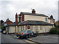
The Former Freemasons Arms Rowhedge
Located on Church Street it closed in late 2007
Image: © Phil Gaskin
Taken: 14 Sep 2010
0.18 miles
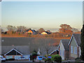
6
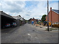
Church Street, East Donyland
Image: © Hamish Griffin
Taken: 13 Jun 2014
0.18 miles
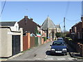
7
Cross Roads, Rowhedge
On Regent Street, which becomes Church Hill, the road which crosses (the left/right road) is Church Street.
Image: © Hamish Griffin
Taken: 13 Jun 2014
0.19 miles
8
Church Hill, Rowhedge
As its name suggests, Church Hill leads to a church in the village of Rowhedge, just outside Colchester.
Image: © Malc McDonald
Taken: 20 Apr 2013
0.20 miles
9
Church Street, East Donyland
St Lawrence Church graveyard is on the right.
Image: © Hamish Griffin
Taken: 13 Jun 2014
0.20 miles
10
Head Street, Rowhedge
Just after the High Street/Marsh Crescent junction.
Image: © Hamish Griffin
Taken: 13 Jun 2014
0.20 miles