IMAGES TAKEN NEAR TO
Vine Road, COLCHESTER, CO5 0LN
Introduction
This page details the photographs taken nearby to Vine Road, CO5 0LN by members of the Geograph project.
The Geograph project started in 2005 with the aim of publishing, organising and preserving representative images for every square kilometre of Great Britain, Ireland and the Isle of Man.

There are currently over 7.5m images from over14,400 individuals and you can help contribute to the project by visiting https://www.geograph.org.uk
Image Map
Images are licensed for reuse under creativecommons.org/licenses/by-sa/2.0
Notes
- Clicking on the map will re-center to the selected point.
- The higher the marker number, the further away the image location is from the centre of the postcode.
Image Listing (29 Images Found)
Images are licensed for reuse under creativecommons.org/licenses/by-sa/2.0
Image
Details
Distance
1
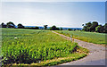
Site of former Inworth station
View NW towards Kelvedon on the course of the former Kelvedon & Tollesbury Light Railway. Inworth station had been nearer Tiptree than Inworth. The station and passenger services had been closed 7/5/51, the line closing eventually on 1/10/62.
Image: © Ben Brooksbank
Taken: 13 Jun 2003
0.08 miles
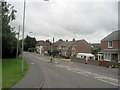
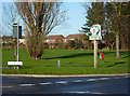
4
Roadsigns on the B1022 Maypole Road
At the junction with the B1023 Kelvedon Road, B1022 Maldon Road & B1023 Church Road
Image: © Geographer
Taken: 10 Sep 2016
0.16 miles
5
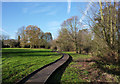
Boardwalk near Grove Lake
The grassy area was wet when I visited indicating the value of the boardwalk. The 1:25,000 map shows the layout of the area much more clearly.
Image: © Andrew Hill
Taken: 5 Dec 2009
0.16 miles
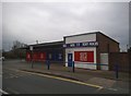
6
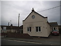
Converted hall on Kelvedon Road, Tiptree
Image: © David Howard
Taken: 4 Apr 2017
0.16 miles
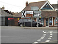
7
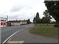
B1023 Kelvedon Road, Tiptree
At the junction with the B1022 Maldon Road, B1022 Maypole Road & B1023 Church Road
Image: © Geographer
Taken: 10 Sep 2016
0.16 miles
8
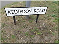
Kelvedon Road sign
On the B1023 Kelvedon Road at the junction with the B1022 Maldon Road, B1022 Maypole Road & B1023 Church Road
Image: © Geographer
Taken: 10 Sep 2016
0.16 miles
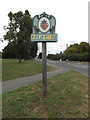
9
Green and Tiptree sign
The sign is by a busy junction at the edge of a green. It does of course feature a picture depicting a link with the jam making industry.
Image: © Andrew Hill
Taken: 5 Dec 2009
0.17 miles
10
Tiptree Village sign
On the B1023 Kelvedon Road at the junction with the B1022 Maypole Road, B1022 Maldon Road & B1023 Church Road
Image: © Geographer
Taken: 10 Sep 2016
0.17 miles