IMAGES TAKEN NEAR TO
Scrivener Close, COLCHESTER, CO4 5ZL
Introduction
This page details the photographs taken nearby to Scrivener Close, CO4 5ZL by members of the Geograph project.
The Geograph project started in 2005 with the aim of publishing, organising and preserving representative images for every square kilometre of Great Britain, Ireland and the Isle of Man.

There are currently over 7.5m images from over14,400 individuals and you can help contribute to the project by visiting https://www.geograph.org.uk
Image Map
Images are licensed for reuse under creativecommons.org/licenses/by-sa/2.0
Notes
- Clicking on the map will re-center to the selected point.
- The higher the marker number, the further away the image location is from the centre of the postcode.
Image Listing (9 Images Found)
Images are licensed for reuse under creativecommons.org/licenses/by-sa/2.0
Image
Details
Distance
1
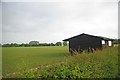
Cavaliers Cricket Club
The Cavaliers Cricket Club http://www.cavaliers-cc.org.uk/index.htm share the same sports ground as
Image http://www.colchesterrugby.co.uk/
Image: © Glyn Baker
Taken: 8 May 2011
0.15 miles
2
Houses on Mill Road
Taken from United Way
Image: © Geographer
Taken: 28 Jun 2015
0.15 miles
3
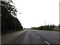
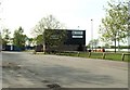
Axial Way, Mile End, Colchester
At the junction with Easter Park
Image: © Geographer
Taken: 28 Jun 2015
0.16 miles
4
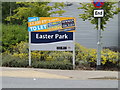
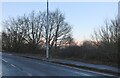
Easter Park sign
On Easter Park at the junction with Axial Way
Image: © Geographer
Taken: 28 Jun 2015
0.17 miles
5
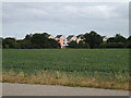
Colchester Rugby Football Club
The club was founded in 1925 and it stands along Mill Road.
Image: © Robert Edwards
Taken: 5 May 2008
0.18 miles
6
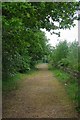
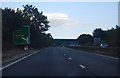
Upgraded Path
This path beside the A12 has been upgraded from a footpath to a bridleway
Image: © Glyn Baker
Taken: 8 May 2011
0.21 miles
7
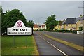
Mill Road, Myland
This area of Colchester has been built up considerably over the past ten to fifteen years.
Image: © Glyn Baker
Taken: 8 May 2011
0.22 miles