IMAGES TAKEN NEAR TO
Cooks Hill, COLCHESTER, CO4 5SS
Introduction
This page details the photographs taken nearby to Cooks Hill, CO4 5SS by members of the Geograph project.
The Geograph project started in 2005 with the aim of publishing, organising and preserving representative images for every square kilometre of Great Britain, Ireland and the Isle of Man.

There are currently over 7.5m images from over14,400 individuals and you can help contribute to the project by visiting https://www.geograph.org.uk
Image Map
Images are licensed for reuse under creativecommons.org/licenses/by-sa/2.0
Notes
- Clicking on the map will re-center to the selected point.
- The higher the marker number, the further away the image location is from the centre of the postcode.
Image Listing (19 Images Found)
Images are licensed for reuse under creativecommons.org/licenses/by-sa/2.0
Image
Details
Distance
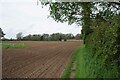
2
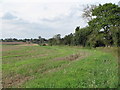
Arable land, Boxted
Field margin and hedgerow on arable land near Cooks Hill, Boxted
Image: © Roger Jones
Taken: 28 Sep 2014
0.06 miles

4
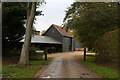
Entrance to Rivers Hall
The Essex Way skirts around the perimeter of the grounds to the hall, before emerging outside the entrance
Image: © Chris Heaton
Taken: 15 Oct 2020
0.17 miles
5
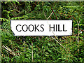
Cooks Hill sign
On Cooks Hill at the junction with Carters & Parsonage Hills
Image: © Geographer
Taken: 16 Aug 2014
0.17 miles
6
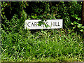
Carters Hill sign
On Carters Hill at the junction with Cookes & Parsonage Hills
Image: © Geographer
Taken: 16 Aug 2014
0.17 miles
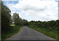
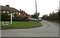
7
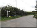
Carters Hill, Boxted
At the junction with Cookes & Parsonage Hills
Image: © Geographer
Taken: 16 Aug 2014
0.18 miles
8
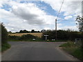
Parsonage Hill, Boxted
At the junction with Cookes & Carters Hills
Image: © Geographer
Taken: 16 Aug 2014
0.18 miles
9
Boxted Footpath #46
Part of the Essex Way.
Image: © Glyn Baker
Taken: 6 May 2023
0.20 miles
10
Houses at Boxted Cross, Essex
The road in the picture is called Cooks Hill, and it leads to Church Street.
Image: © Robert Edwards
Taken: 9 Oct 2006
0.21 miles