IMAGES TAKEN NEAR TO
Orchard Place, COLCHESTER, CO4 5JW
Introduction
This page details the photographs taken nearby to Orchard Place, CO4 5JW by members of the Geograph project.
The Geograph project started in 2005 with the aim of publishing, organising and preserving representative images for every square kilometre of Great Britain, Ireland and the Isle of Man.

There are currently over 7.5m images from over14,400 individuals and you can help contribute to the project by visiting https://www.geograph.org.uk
Image Map
Images are licensed for reuse under creativecommons.org/licenses/by-sa/2.0
Notes
- Clicking on the map will re-center to the selected point.
- The higher the marker number, the further away the image location is from the centre of the postcode.
Image Listing (4 Images Found)
Images are licensed for reuse under creativecommons.org/licenses/by-sa/2.0
Image
Details
Distance
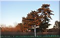
1

Conifers by Via Urbis Romanae, Mile End
Image: © David Howard
Taken: 6 Feb 2022
0.20 miles
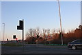
2
Via Urbis Romanae, Mile End
Colchester is Britain's oldest town (according to the signs), and a Roman centre. Although this not a straight road it has the Latin name of the Roman road.
Image: © David Howard
Taken: 23 Feb 2019
0.22 miles
4
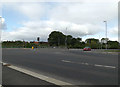
A134 Nayland Road, Mile End
At the junction with the A134 Via Urbis Romanae
Image: © Geographer
Taken: 14 May 2016
0.24 miles