IMAGES TAKEN NEAR TO
Hawthorn Avenue, COLCHESTER, CO4 3JP
Introduction
This page details the photographs taken nearby to Hawthorn Avenue, CO4 3JP by members of the Geograph project.
The Geograph project started in 2005 with the aim of publishing, organising and preserving representative images for every square kilometre of Great Britain, Ireland and the Isle of Man.

There are currently over 7.5m images from over14,400 individuals and you can help contribute to the project by visiting https://www.geograph.org.uk
Image Map
Images are licensed for reuse under creativecommons.org/licenses/by-sa/2.0
Notes
- Clicking on the map will re-center to the selected point.
- The higher the marker number, the further away the image location is from the centre of the postcode.
Image Listing (8 Images Found)
Images are licensed for reuse under creativecommons.org/licenses/by-sa/2.0
Image
Details
Distance
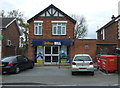
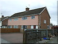
1

Sir Charles Lucas Arts College
Comprehensive School named after the leader of the Royalist Army during the siege of Colchester in the English Civil War.
Image: © Angela Tuff
Taken: 24 Jan 2006
0.16 miles
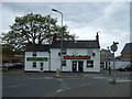
2

Bus shelter in Parson's Heath, Harwich Road
Image: © David Smith
Taken: 31 May 2017
0.22 miles
3
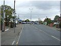
Bus stop on Harwich Road, Colchester
Looking east.
Image: © JThomas
Taken: 24 Apr 2017
0.23 miles
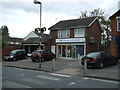
8
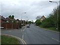
Harwich Road, Colchester
Looking north east at the junction with Hazelton Road.
Image: © JThomas
Taken: 24 Apr 2017
0.25 miles