IMAGES TAKEN NEAR TO
Hazelton Road, COLCHESTER, CO4 3DX
Introduction
This page details the photographs taken nearby to Hazelton Road, CO4 3DX by members of the Geograph project.
The Geograph project started in 2005 with the aim of publishing, organising and preserving representative images for every square kilometre of Great Britain, Ireland and the Isle of Man.

There are currently over 7.5m images from over14,400 individuals and you can help contribute to the project by visiting https://www.geograph.org.uk
Image Map
Images are licensed for reuse under creativecommons.org/licenses/by-sa/2.0
Notes
- Clicking on the map will re-center to the selected point.
- The higher the marker number, the further away the image location is from the centre of the postcode.
Image Listing (21 Images Found)
Images are licensed for reuse under creativecommons.org/licenses/by-sa/2.0
Image
Details
Distance
1
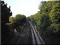
Railway line from bridge looking toward Colchester North
Image: © PAUL FARMER
Taken: 26 Jun 2010
0.10 miles
2
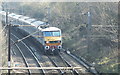
London bound
Approaching Colchester, Greater Anglia class 90 locomotive hauls a Norwich to London, Liverpool Street, train through the cutting at Parsons Heath, Colchester Essex. Picture taken from the St Dominics Rd footbridge.
Image: © Peter Pearson
Taken: 5 Mar 2013
0.10 miles
3
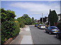
St Faith Road Colchester
This picture is taken looking toward St Dominic Way
Image: © PAUL FARMER
Taken: 17 Feb 2010
0.12 miles
4
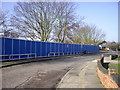
Temporary fencing in St Monance Way Colchester
Behind the fence is the site of a former old peoples home which has now been demolished
Image: © PAUL FARMER
Taken: 17 Feb 2010
0.13 miles
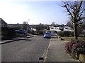
5
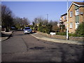
St Brides Court, St John's Estate, Colchester
Image: © PAUL FARMER
Taken: 21 Jun 2010
0.16 miles
7
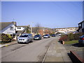
Cloverlands, St Johns Estate Colchester
Image: © PAUL FARMER
Taken: 10 Jul 2010
0.19 miles
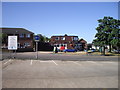
8
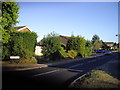
St Dominic Way Colchester
This picture is taken looking toward the shops in St Christopher Parade
Image: © PAUL FARMER
Taken: 17 Feb 2010
0.19 miles
9
The Friar Public House St. Christopher Road
Image: © PAUL FARMER
Taken: 4 Jul 2010
0.19 miles
10
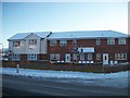
St Christopher Court St Christopher Road Colchester
This block of flats is built on the site of a former petrol station at the junction of St Christopher Road and St Monance Way
Image: © PAUL FARMER
Taken: 19 Dec 2009
0.20 miles