1
Abbots Road leading to Old Heath
Viewed from Mersea Road
Image: © John Firth
Taken: 14 Sep 2010
0.06 miles
2
Bus shelter by the wall of Colchester cemetery
In Mersea Road, B1025
Image: © David Smith
Taken: 31 May 2017
0.07 miles
3
Colchester cemetery plan by the southern entrance
The southern entrance serves the crematorium as well as the main body of the vast cemetery. Many unhelpful cemeteries don't publish a plan and the only way to find out which plot is which is to ask the groundsmen who of course don't work at weekends. Colchester's 67 acre cemetery is immaculately kept and has rightly won awards.
Image: © Adrian S Pye
Taken: 23 Jan 2017
0.08 miles
4
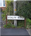
Stalin Rd
One of only two Streets in the country left honouring “Joe Stalin”. The Barn Hall Estate in Colchester was planned and built in the immediate aftermath of WW2 before the Cold War got started or the horrific truth of Stalin’s rule of the Soviet Union became fully known. I suppose the set of Churchill Way and Roosevelt Way would not be complete without the third member of the “big three”. The other town I know of with a sense of history big enough not to edit out Stalin from their street names is Chatham in Kent.
Image: © Glyn Baker
Taken: 19 May 2007
0.15 miles
5
Stalin Road, Colchester
Looking south from the corner of Roosevelt Way.
The street-names must - I suppose - date from the time of the Yalta agreement.
Image: © Stefan Czapski
Taken: 5 Sep 2015
0.16 miles
6
Colchester cemetery, Anglican chapel
Image: © Adrian S Pye
Taken: 23 Jan 2017
0.18 miles
7
Colchester cemetery on a frosty & foggy morning
There are 267 Commonwealth burials of the 1914-1918 war, one being unidentified, eleven Australian graves are together in a group nearby, the remainder being scattered. After the war a Cross of Sacrifice was erected on a site overlooking both the plot and the group of war graves, in honour of all the servicemen buried here.
There are also 114 Commonwealth burials of the 1939-1945 war here, 1 of which is unidentified.
There are also 7 Foreign National burials.
Image: © Adrian S Pye
Taken: 23 Jan 2017
0.19 miles
8
The headstone of Yep Fook
Yep Fook was a Chinese labourer in the Chinese Labour Corps. He died in Colchester Hospital 9th November 1918.
The Chinese Labour Corps, nicknamed the Celestials, were Chinese auxiliaries sent to work for French and British troops during the First World War and do the hardest menial jobs.
He was presumably injured on the battlefield and brought to Colchester for treatment, where he ultimately died only two days before the end of the war.
Image: © Adrian S Pye
Taken: 23 Jan 2017
0.20 miles
9
The Willows
Open space and power lines in Colchester.
Image: © Burgess Von Thunen
Taken: 3 May 2012
0.20 miles
10
Street-name sign, Stalin Road
Quite a surprise to find that Colchester hasn't air-brushed Stalin out of history. Uncle Joe would have shown no such tender regard for those who resisted him.
Image: © Stefan Czapski
Taken: 5 Sep 2015
0.21 miles


