IMAGES TAKEN NEAR TO
Wych Elm, COLCHESTER, CO2 8PR
Introduction
This page details the photographs taken nearby to Wych Elm, CO2 8PR by members of the Geograph project.
The Geograph project started in 2005 with the aim of publishing, organising and preserving representative images for every square kilometre of Great Britain, Ireland and the Isle of Man.

There are currently over 7.5m images from over14,400 individuals and you can help contribute to the project by visiting https://www.geograph.org.uk
Image Map
Images are licensed for reuse under creativecommons.org/licenses/by-sa/2.0
Notes
- Clicking on the map will re-center to the selected point.
- The higher the marker number, the further away the image location is from the centre of the postcode.
Image Listing (7 Images Found)
Images are licensed for reuse under creativecommons.org/licenses/by-sa/2.0
Image
Details
Distance
1
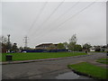
The Willows
Open space and power lines in Colchester.
Image: © Burgess Von Thunen
Taken: 3 May 2012
0.15 miles
2
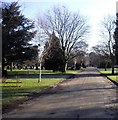
Road within Colchester Cemetery
The cemetery consists of 67 acres of land on the west side of Mersea Road.
Image: © PAUL FARMER
Taken: 2 Mar 2010
0.16 miles
3
Colchester Cemetery Mersea Road
The cemetery consists of 67 acres of land on the west side of Mersea Road.
Image: © PAUL FARMER
Taken: 4 Jul 2009
0.18 miles
4
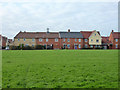
Fairly new housing, Colchester
On Secundus Drive.
Image: © Robin Webster
Taken: 17 Jan 2016
0.19 miles
5
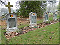
Graves of Belgian soldiers
Four Belgian soldiers died in Colchester in 1914.
Fernand Emiel Louis Juul BAUDOUR (19)
Pierre Felicien VERDOODT (19)
Camille Agustin COQUETTE (24)
Jean Baptiste Rene VAN BOSSUYT (27)
Image: © Adrian S Pye
Taken: 23 Jan 2017
0.20 miles
6
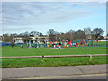
Play area near Monkwick schools
One of the schools is beyond.
Image: © Robin Webster
Taken: 17 Jan 2016
0.22 miles
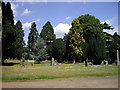
7
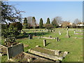
The western side of Colchester cemetery
Image: © Adrian S Pye
Taken: 13 Feb 2017
0.24 miles