IMAGES TAKEN NEAR TO
Viceroy Close, COLCHESTER, CO2 8BQ

Introduction

This page details the photographs taken nearby to Viceroy Close, CO2 8BQ by members of the Geograph project.

The Geograph project started in 2005 with the aim of publishing, organising and preserving representative images for every square kilometre of Great Britain, Ireland and the Isle of Man.

There are currently over 7.5m images from over14,400 individuals and you can help contribute to the project by visiting https://www.geograph.org.uk

Image Map


Images are licensed for reuse under creativecommons.org/licenses/by-sa/2.0
Notes
  • Clicking on the map will re-center to the selected point.
  • The higher the marker number, the further away the image location is from the centre of the postcode.

Image Listing (11 Images Found)

Images are licensed for reuse under creativecommons.org/licenses/by-sa/2.0
Image
Details
Distance
1
The Co-op Supermarket on Abbot's Road
Image: © Robert Edwards Taken: 14 May 2008
0.04 miles
2
A frosty morn in Middlewick ranges
Image: © Mr James D Taken: 10 Jan 2000
0.16 miles
3
Stalin Road, Colchester
Looking south from the corner of Roosevelt Way. The street-names must - I suppose - date from the time of the Yalta agreement.
Image: © Stefan Czapski Taken: 5 Sep 2015
0.17 miles
4
Roosevelt Way, Colchester
Seen from the corner of Stalin Road.
Image: © Stefan Czapski Taken: 5 Sep 2015
0.20 miles
5
Cavendish Avenue
1920s semis in Old Heath.
Image: © Burgess Von Thunen Taken: 18 Oct 2012
0.20 miles
6
Abbots Road leading to Old Heath
Viewed from Mersea Road
Image: © John Firth Taken: 14 Sep 2010
0.21 miles
7
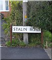
Street-name sign, Stalin Road
Quite a surprise to find that Colchester hasn't air-brushed Stalin out of history. Uncle Joe would have shown no such tender regard for those who resisted him.
Image: © Stefan Czapski Taken: 5 Sep 2015
0.22 miles
8
Bourne valley, Colchester
Image: © Mr James D Taken: 9 Apr 2008
0.22 miles
9
Boardwalk in woodland below Bourne Pond
Part of the footpath from Bourne Mill to Distillery Pond
Image: © David Smith Taken: 31 May 2017
0.23 miles
10
Boardwalk in woods west of Bourne Pond
Part of the footpath to Distillery Road
Image: © David Smith Taken: 31 May 2017
0.24 miles