IMAGES TAKEN NEAR TO
Layer Breton Hill, COLCHESTER, CO2 0PR
Introduction
This page details the photographs taken nearby to Layer Breton Hill, CO2 0PR by members of the Geograph project.
The Geograph project started in 2005 with the aim of publishing, organising and preserving representative images for every square kilometre of Great Britain, Ireland and the Isle of Man.

There are currently over 7.5m images from over14,400 individuals and you can help contribute to the project by visiting https://www.geograph.org.uk
Image Map
Images are licensed for reuse under creativecommons.org/licenses/by-sa/2.0
Notes
- Clicking on the map will re-center to the selected point.
- The higher the marker number, the further away the image location is from the centre of the postcode.
Image Listing (13 Images Found)
Images are licensed for reuse under creativecommons.org/licenses/by-sa/2.0
Image
Details
Distance
1
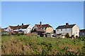
Houses on Layer Breton Hill
The rear of the houses, looking from Lower Road.
Image: © Robin Webster
Taken: 28 Nov 2017
0.11 miles
2
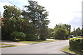
Layer Breton Hill
Hills are rather modest around here.
Image: © Robin Webster
Taken: 28 Nov 2017
0.14 miles
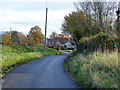
3
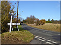
Layer Breton
Taken from the end of Shatters Road. The road ahead is Layer Breton Hill.
Image: © Trevor Harris
Taken: 31 Jul 2015
0.15 miles
4
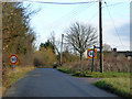
30 limit, Shatters Road, Layer Breton
Image: © Robin Webster
Taken: 28 Nov 2017
0.18 miles
6
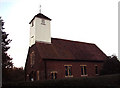
St Mary the Virgin Church, Layer Bretton, Essex
Image: © Peter Stack
Taken: 22 Nov 2009
0.22 miles
7
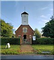
Layer Breton church
The Church of St. Mary the Virgin is in a small inclosure of the common land of Layer Breton Heath.
Image: © Robin Webster
Taken: 28 Nov 2017
0.22 miles
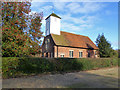
8
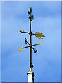
Weather vane, Layer Breton church
For the rest of the church, see Image
Image: © Robin Webster
Taken: 28 Nov 2017
0.22 miles
9
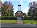
Layer Breton church
The Church of St. Mary the Virgin is in a small inclosure of the common land of Layer Breton Heath.
Image: © Robin Webster
Taken: 28 Nov 2017
0.22 miles