IMAGES TAKEN NEAR TO
Clay Lane, CLACTON-ON-SEA, CO16 8HH
Introduction
This page details the photographs taken nearby to Clay Lane, CO16 8HH by members of the Geograph project.
The Geograph project started in 2005 with the aim of publishing, organising and preserving representative images for every square kilometre of Great Britain, Ireland and the Isle of Man.

There are currently over 7.5m images from over14,400 individuals and you can help contribute to the project by visiting https://www.geograph.org.uk
Image Map
Images are licensed for reuse under creativecommons.org/licenses/by-sa/2.0
Notes
- Clicking on the map will re-center to the selected point.
- The higher the marker number, the further away the image location is from the centre of the postcode.
Image Listing (12 Images Found)
Images are licensed for reuse under creativecommons.org/licenses/by-sa/2.0
Image
Details
Distance
1

New Barn Near Oak Lodge
The fields around are for outdoor reared pigs. I wonder if the barn is to provide more shelter in inclement weather.
Image: © Glyn Baker
Taken: 8 Jul 2023
0.03 miles
2
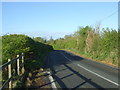
Clay Lane towards St Osyth
Looking south west.
Image: © JThomas
Taken: 28 Apr 2017
0.06 miles
3
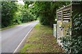
Kiln Cottage Electricity Substation
Located on Clay Lane near Image
Image: © Glyn Baker
Taken: 8 Jul 2023
0.08 miles
5
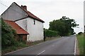
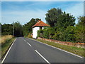
Kiln Cottage
The cottage on Clay Lane gives its name to Image
Image: © Glyn Baker
Taken: 8 Jul 2023
0.10 miles
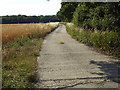
7
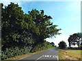
Clay Lane, near St. Osyth
Clay Lane passing through north Essex countryside, near St. Osyth.
Image: © Malc McDonald
Taken: 18 Jul 2015
0.12 miles
8
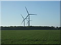
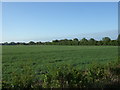
Crop field and wind turbines near St Osyth Heath
Off Clay Lane.
Image: © JThomas
Taken: 28 Apr 2017
0.13 miles
9
Flagpole on Clay Lane
On the drive to Follow Hall.
Image: © Glyn Baker
Taken: 8 Jul 2023
0.15 miles
10
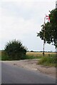
Track near St. Osyth
This track leads to an isolated house near St. Osyth, in north Essex.
Image: © Malc McDonald
Taken: 18 Jul 2015
0.15 miles