IMAGES TAKEN NEAR TO
Frinton Road, FRINTON-ON-SEA, CO13 0PA
Introduction
This page details the photographs taken nearby to Frinton Road, CO13 0PA by members of the Geograph project.
The Geograph project started in 2005 with the aim of publishing, organising and preserving representative images for every square kilometre of Great Britain, Ireland and the Isle of Man.

There are currently over 7.5m images from over14,400 individuals and you can help contribute to the project by visiting https://www.geograph.org.uk
Image Map (Loading...)


Getting Data...Please wait
Leaflet Map data © OpenStreetMap
Images are licensed for reuse under creativecommons.org/licenses/by-sa/2.0
Notes
- Clicking on the map will re-center to the selected point.
- The higher the marker number, the further away the image location is from the centre of the postcode.
Image Listing (6 Images Found)
Images are licensed for reuse under creativecommons.org/licenses/by-sa/2.0
Image
Details
Distance
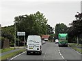
3
Frietuna Road, Frinton
From Walton Road
Image: © David Howard
Taken: 4 Apr 2017
0.14 miles
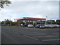
5
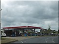
Esso filling station, B1033, Frinton Road
Image: © David Smith
Taken: 16 Jun 2014
0.19 miles
6
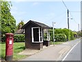
Post box and bus shelter by B1033
The bus shelter is at the end of a green open space, giving easy access from the housing estate nearby
Image: © David Smith
Taken: 31 May 2017
0.22 miles