IMAGES TAKEN NEAR TO
Colchester Road, HARWICH, CO12 5DE
Introduction
This page details the photographs taken nearby to Colchester Road, CO12 5DE by members of the Geograph project.
The Geograph project started in 2005 with the aim of publishing, organising and preserving representative images for every square kilometre of Great Britain, Ireland and the Isle of Man.

There are currently over 7.5m images from over14,400 individuals and you can help contribute to the project by visiting https://www.geograph.org.uk
Image Map
Images are licensed for reuse under creativecommons.org/licenses/by-sa/2.0
Notes
- Clicking on the map will re-center to the selected point.
- The higher the marker number, the further away the image location is from the centre of the postcode.
Image Listing (5 Images Found)
Images are licensed for reuse under creativecommons.org/licenses/by-sa/2.0
Image
Details
Distance
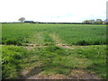
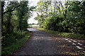
1
National Cycle Route 51 near Stones Green
Looking north.
Image: © JThomas
Taken: 26 Apr 2017
0.03 miles
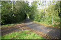
2
Stonehall Lane
Rural lane nr Stones green block farm
Image: © roger geach
Taken: 31 Oct 2012
0.10 miles