IMAGES TAKEN NEAR TO
Bromley Road, MANNINGTREE, CO11 2QF
Introduction
This page details the photographs taken nearby to Bromley Road, CO11 2QF by members of the Geograph project.
The Geograph project started in 2005 with the aim of publishing, organising and preserving representative images for every square kilometre of Great Britain, Ireland and the Isle of Man.

There are currently over 7.5m images from over14,400 individuals and you can help contribute to the project by visiting https://www.geograph.org.uk
Image Map
Images are licensed for reuse under creativecommons.org/licenses/by-sa/2.0
Notes
- Clicking on the map will re-center to the selected point.
- The higher the marker number, the further away the image location is from the centre of the postcode.
Image Listing (12 Images Found)
Images are licensed for reuse under creativecommons.org/licenses/by-sa/2.0
Image
Details
Distance
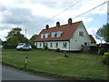
6
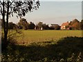
Hollylodge Farm, seen from Bromley Road
Image: © Robert Edwards
Taken: 6 Nov 2006
0.16 miles
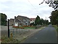
7
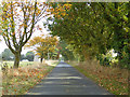
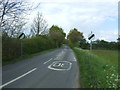
Chequers Road
Heading east on a long straight.
Image: © Robin Webster
Taken: 30 Oct 2016
0.17 miles
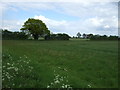
9
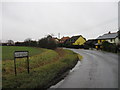
Chequers Road
Rose farm on Chequers Road Little Bromley, Essex.
Image: © Keith Evans
Taken: 11 Oct 2017
0.22 miles
10
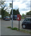
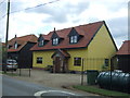
Elizabeth II postbox and bus stop on Shop Road, Little Bentley
Image: © JThomas
Taken: 25 Apr 2017
0.25 miles