IMAGES TAKEN NEAR TO
Rosewood Park, MANNINGTREE, CO11 1UA
Introduction
This page details the photographs taken nearby to Rosewood Park, CO11 1UA by members of the Geograph project.
The Geograph project started in 2005 with the aim of publishing, organising and preserving representative images for every square kilometre of Great Britain, Ireland and the Isle of Man.

There are currently over 7.5m images from over14,400 individuals and you can help contribute to the project by visiting https://www.geograph.org.uk
Image Map
Images are licensed for reuse under creativecommons.org/licenses/by-sa/2.0
Notes
- Clicking on the map will re-center to the selected point.
- The higher the marker number, the further away the image location is from the centre of the postcode.
Image Listing (65 Images Found)
Images are licensed for reuse under creativecommons.org/licenses/by-sa/2.0
Image
Details
Distance
1
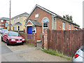
Mistley Methodist chapel
Tucked away down Chapel Cut, a bit of a glorified back alley.
Image: © Robin Webster
Taken: 30 Oct 2016
0.09 miles
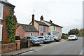
2

Chapel Cut, Mistley
The chapel is the building with a porch on the left.
Image: © Robin Webster
Taken: 30 Oct 2016
0.09 miles
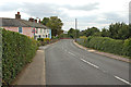
3
Cottages, Beckford Road, Mistley
The cottages continue round the corner onto Harwich Road.
Image: © Robin Webster
Taken: 30 Oct 2016
0.11 miles
4

Cottages, Harwich Road, Mistley
These continue round the far corner onto Beckford Road.
Image: © Robin Webster
Taken: 30 Oct 2016
0.12 miles
7
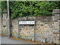
School Lane sign
On School Lane at the junction with the B1352 Harwich Road & B1352 High Street
Image: © Geographer
Taken: 17 Aug 2018
0.13 miles
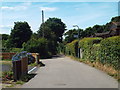
8
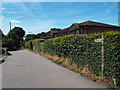
Shrublands Road, Mistley
The sign to the right of the image indicates the route of a public footpath.
Image: © Malc McDonald
Taken: 18 Jul 2015
0.13 miles
9
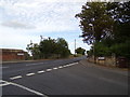
B1352 Harwich Road, Mistley
At the junction with the B1352 High Street & School Lane
Image: © Geographer
Taken: 17 Aug 2018
0.13 miles
10
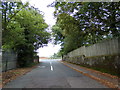
School Lane, Mistley
At the junction with the B1352 High Street & B1352 Harwich Road
Image: © Geographer
Taken: 17 Aug 2018
0.14 miles