IMAGES TAKEN NEAR TO
Rowley Close, MANNINGTREE, CO11 1RR
Introduction
This page details the photographs taken nearby to Rowley Close, CO11 1RR by members of the Geograph project.
The Geograph project started in 2005 with the aim of publishing, organising and preserving representative images for every square kilometre of Great Britain, Ireland and the Isle of Man.

There are currently over 7.5m images from over14,400 individuals and you can help contribute to the project by visiting https://www.geograph.org.uk
Image Map
Images are licensed for reuse under creativecommons.org/licenses/by-sa/2.0
Notes
- Clicking on the map will re-center to the selected point.
- The higher the marker number, the further away the image location is from the centre of the postcode.
Image Listing (17 Images Found)
Images are licensed for reuse under creativecommons.org/licenses/by-sa/2.0
Image
Details
Distance
4
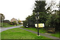
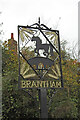
Brantham village sign
See a close up and more about the sign here
https://www.geograph.org.uk/photo/6650945
Image: © Adrian S Pye
Taken: 24 Oct 2020
0.15 miles
5
Brantham village sign
The sign is strikingly simple with three ears of barley at each corner, a pony on a bridge with bulrushes.
The barley must relate to the agricultural heritage for I find no maltsters or breweries. The pony which stands on a less noticeable Brantham or Cattawade Bridge over Stutton Brook https://www.geograph.org.uk/photo/748596 must relate to the Brantham Cup, keenly competed for within the Pony club. As with all the information I am delighted to be corrected if I’m wrong.
Image: © Adrian S Pye
Taken: 24 Oct 2020
0.16 miles
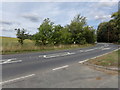
7
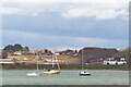
South-east area of Brantham Industrial Estate 2021
Nine years ago there was just empty land between the factories and the old established estate. In 2019 there was some movement and the builders were starting to lay out the grounds for the Stour View Estate! Considering that both banks of the River Stour are declared to be a place of natural beauty this estate will enhance the view from Manningtree. Maybe in eighteen months' time (the end of 2022) the estate will be completed (please note that the image covers about twelve squares of the map).
Image: © Tony Peacock
Taken: 15 Apr 2021
0.20 miles
8
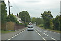
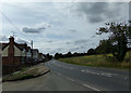
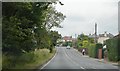
Brooklands Road, Cattawade
Near Brantham Village Hall
Image: © Geographer
Taken: 17 Aug 2018
0.20 miles
9
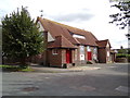
Brantham Village Hall
On Brooklands Road
http://brantham.onesuffolk.net/village-hall/
Image: © Geographer
Taken: 17 Aug 2018
0.21 miles
10
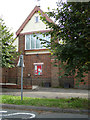
Brantham Village Hall sign
On Brooklands Road
http://brantham.onesuffolk.net/village-hall/
Image: © Geographer
Taken: 17 Aug 2018
0.21 miles