IMAGES TAKEN NEAR TO
Stradishall Road, SUDBURY, CO10 8EU
Introduction
This page details the photographs taken nearby to Stradishall Road, CO10 8EU by members of the Geograph project.
The Geograph project started in 2005 with the aim of publishing, organising and preserving representative images for every square kilometre of Great Britain, Ireland and the Isle of Man.

There are currently over 7.5m images from over14,400 individuals and you can help contribute to the project by visiting https://www.geograph.org.uk
Image Map
Images are licensed for reuse under creativecommons.org/licenses/by-sa/2.0
Notes
- Clicking on the map will re-center to the selected point.
- The higher the marker number, the further away the image location is from the centre of the postcode.
Image Listing (9 Images Found)
Images are licensed for reuse under creativecommons.org/licenses/by-sa/2.0
Image
Details
Distance
1
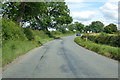
The B1063
Looking south along the B1063 near to Stradishall, Suffolk.
Image: © Keith Evans
Taken: 15 Nov 2017
0.10 miles
2
The B1063, heading towards Chilton Street
Image: © Robert Edwards
Taken: 13 Jul 2009
0.16 miles
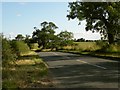
3
Entering Hundon on the B1063 Stradisall Road
Image: © Geographer
Taken: 3 Oct 2014
0.18 miles
4
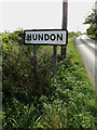
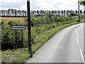
Hundon Village Name sign
On the B1063 Stradishall Road
Image: © Geographer
Taken: 3 Oct 2014
0.18 miles
5
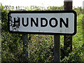
Hundon Village Name sign
On the B1063 Stradishall Road
(Close up)
Image: © Geographer
Taken: 3 Oct 2014
0.18 miles
6
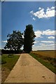
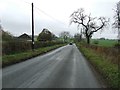
Track to Appleacre Farm
This private farm track leads east from the B1063, north of Hundon.
Image: © Bob Jones
Taken: 14 Jul 2006
0.18 miles
7
B1063 Stradishall Road, Stradishall
Near Hundon Village Name sign
Image: © Geographer
Taken: 3 Oct 2014
0.18 miles
8
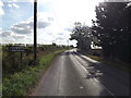
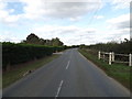
B1063 Stradishall Road
Towards Stradishall.
Image: © Robin Webster
Taken: 12 Jul 2020
0.18 miles