IMAGES TAKEN NEAR TO
Clare Road, SUDBURY, CO10 8DJ
Introduction
This page details the photographs taken nearby to Clare Road, CO10 8DJ by members of the Geograph project.
The Geograph project started in 2005 with the aim of publishing, organising and preserving representative images for every square kilometre of Great Britain, Ireland and the Isle of Man.

There are currently over 7.5m images from over14,400 individuals and you can help contribute to the project by visiting https://www.geograph.org.uk
Image Map
Images are licensed for reuse under creativecommons.org/licenses/by-sa/2.0
Notes
- Clicking on the map will re-center to the selected point.
- The higher the marker number, the further away the image location is from the centre of the postcode.
Image Listing (5 Images Found)
Images are licensed for reuse under creativecommons.org/licenses/by-sa/2.0
Image
Details
Distance
1
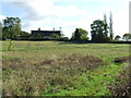
Hundon Thicks Farm
Hundon Thicks Farm near to Hundon, Suffolk.
Image: © Keith Evans
Taken: 20 Oct 2011
0.01 miles
2
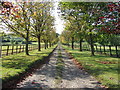
Tree Lined Drive
Looking along the tree lined drive at Hundon Thicks Farm at Hundon, Suffolk.
Image: © Keith Evans
Taken: 20 Oct 2011
0.12 miles
3
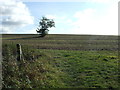
Into The Field
Footpath across the field near to Hundon, Suffolk.
Image: © Keith Evans
Taken: 20 Oct 2011
0.19 miles
4
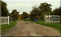
Road to Hundon Thicks Farm, Hundon, Suffolk
Image: © Robert Edwards
Taken: 30 Oct 2006
0.19 miles
5
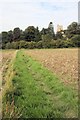
Footpath to Hundon Church
The public footpath from Hundon Thicks Farm approaches the church, which is in the adjacent square.
Image: © Bob Jones
Taken: 9 Sep 2010
0.23 miles