IMAGES TAKEN NEAR TO
Glemsford Road, SUDBURY, CO10 7GA
Introduction
This page details the photographs taken nearby to Glemsford Road, CO10 7GA by members of the Geograph project.
The Geograph project started in 2005 with the aim of publishing, organising and preserving representative images for every square kilometre of Great Britain, Ireland and the Isle of Man.

There are currently over 7.5m images from over14,400 individuals and you can help contribute to the project by visiting https://www.geograph.org.uk
Image Map
Images are licensed for reuse under creativecommons.org/licenses/by-sa/2.0
Notes
- Clicking on the map will re-center to the selected point.
- The higher the marker number, the further away the image location is from the centre of the postcode.
Image Listing (31 Images Found)
Images are licensed for reuse under creativecommons.org/licenses/by-sa/2.0
Image
Details
Distance
1
Liston Lane, Foxearth
At the junction with Pentlow Road
Image: © Geographer
Taken: 14 Jun 2014
0.07 miles
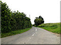
2
Pentlow Road, Foxearth
At the junction with Liston Lane
Image: © Geographer
Taken: 14 Jun 2014
0.07 miles
3
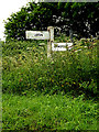
Roadsign on Pentlow Road
At the junction with Liston lane
Image: © Geographer
Taken: 14 Jun 2014
0.07 miles
4
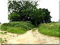
Bridleway to Pentlow Street
Off Pentlow Road at the junction with Liston Lane
Image: © Geographer
Taken: 14 Jun 2014
0.07 miles
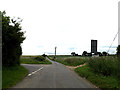
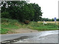
5

Junction on the Lane Between Glemsford & Foxearth
The end of Bridleway 102_2
Image: © Glyn Baker
Taken: 3 Jun 2021
0.07 miles
6
Blocked bridleway
Blocked bridleway by a fallen tree near to Pentlow Street Suffolk.
Image: © Keith Evans
Taken: 3 Aug 2008
0.09 miles
7
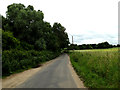
Pentlow Road, Glemsford
Near Glemsford Picnic Area
Image: © Geographer
Taken: 14 Jun 2014
0.16 miles
8
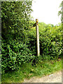
Footpath sign off Pentlow Road
Near Glemsford Picnic Area
Image: © Geographer
Taken: 14 Jun 2014
0.16 miles
9
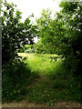
Footpath to Liston Gardens
Off Pentlow Road near Glemsford Picnic Area
Image: © Geographer
Taken: 14 Jun 2014
0.17 miles
10
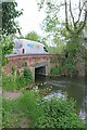
Bridge over The Stour Near Glemsford
Looking upstream.
Image: © Glyn Baker
Taken: 3 Jun 2021
0.17 miles