IMAGES TAKEN NEAR TO
Further Street, SUDBURY, CO10 5LD
Introduction
This page details the photographs taken nearby to Further Street, CO10 5LD by members of the Geograph project.
The Geograph project started in 2005 with the aim of publishing, organising and preserving representative images for every square kilometre of Great Britain, Ireland and the Isle of Man.

There are currently over 7.5m images from over14,400 individuals and you can help contribute to the project by visiting https://www.geograph.org.uk
Image Map
Images are licensed for reuse under creativecommons.org/licenses/by-sa/2.0
Notes
- Clicking on the map will re-center to the selected point.
- The higher the marker number, the further away the image location is from the centre of the postcode.
Image Listing (14 Images Found)
Images are licensed for reuse under creativecommons.org/licenses/by-sa/2.0
Image
Details
Distance
1
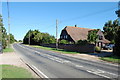
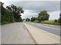
Willow Farm, Assington
Farm on the busy A134
Image: © John Myers
Taken: 14 Aug 2013
0.02 miles
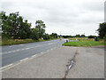
2
Road Junction
Road junction of the A.134 with Dyers Lane on the right near to Assington, Suffolk.
Image: © Keith Evans
Taken: 14 Nov 2013
0.07 miles
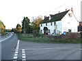
3
Assington, Further Street: Looking towards the farmhouse, Willow Farm
Image: © Michael Garlick
Taken: 3 Jul 2020
0.08 miles
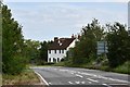
5
A134 Further Street, Assington
At the junction with the A134 Assington Road & A1071 Boxford Lane
Image: © Geographer
Taken: 10 Jul 2021
0.13 miles
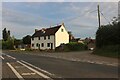
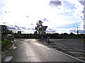
6
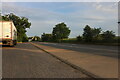
Parking area on Further Street, Assington
Image: © David Howard
Taken: 22 May 2022
0.16 miles
7
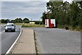
Assington, Further Street: Large lay-by
Image: © Michael Garlick
Taken: 3 Jul 2020
0.19 miles
8
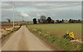
Dyers Lane
This is the view from Park Farm.
Image: © Robert Edwards
Taken: 21 Mar 2007
0.21 miles
9
A134 Further Street, Assington
At the junction with the A134 Assington Road & A1071 Boxford Lane
Image: © Geographer
Taken: 10 Jul 2021
0.22 miles
10
A1071 Boxford Lane, Newton
At the junction with the A134 Assington Road & Further Street
Image: © Geographer
Taken: 4 Oct 2013
0.22 miles