IMAGES TAKEN NEAR TO
Brook Close, MALDON, CM9 6RG

Introduction

This page details the photographs taken nearby to Brook Close, CM9 6RG by members of the Geograph project.

The Geograph project started in 2005 with the aim of publishing, organising and preserving representative images for every square kilometre of Great Britain, Ireland and the Isle of Man.

There are currently over 7.5m images from over14,400 individuals and you can help contribute to the project by visiting https://www.geograph.org.uk

Image Map


Images are licensed for reuse under creativecommons.org/licenses/by-sa/2.0
Notes
  • Clicking on the map will re-center to the selected point.
  • The higher the marker number, the further away the image location is from the centre of the postcode.

Image Listing (23 Images Found)

Images are licensed for reuse under creativecommons.org/licenses/by-sa/2.0
  • ...
Image
Details
Distance
1
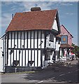
Bell Inn, Woodham Walter, Essex
This inn dates from the late 16th to early 17th century.
Image: © Robert Edwards Taken: 8 Feb 2006
0.01 miles
2
The Bell, Woodham Walter
One of three pubs in the village, with the Queen Victoria Image and the Cats Image
Image: © John Myers Taken: 1 Sep 2006
0.04 miles
3
The Bell, Woodham Walter
Still closed for the afternoon when I passed by.
Image: © Glyn Baker Taken: 6 May 2016
0.04 miles
4
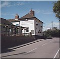
'The Queen Victoria' public house at Woodham Walter, Essex
Image: © Robert Edwards Taken: 18 Oct 2006
0.05 miles
5
The Queen Victoria, Woodham Walter
One of three pubs in Woodham Walter.
Image: © John Myers Taken: 1 Sep 2006
0.05 miles
6
Cottages, Woodham Walter
These cottages beside The Bell (seen on the left behind the tree) are lit by late afternoon sun.
Image: © Trevor Harris Taken: 15 Jan 2012
0.05 miles
7
The Bell pub from the Recreation ground
Image: © Paul Franks Taken: 17 Aug 2018
0.05 miles
8
View of Woodham Walter village
The view of the village from the footpath by the church.
Image: © Paul Franks Taken: 17 Aug 2018
0.06 miles
9
Direction Sign ? Signpost in Woodham Walter
Located opposite The Bell public house on a grass triangle in the centre of the junction of Church Hill, The Street and Little Baddow Road in Woodham Walter parish. 3 arms and half-moon finial. See also https://www.flickr.com/photos/boxster986/7179465246/. Milestone Society National ID: EX_TL8006A
Image: © John V Nicholls Taken: Unknown
0.06 miles
10
Memorial Garden
This verge is maintained as a Memorial Garden in Memory of those from the village who were killed in WW1. To me a much more fitting remembrance than a lump of stone gathered around once a year.
Image: © Glyn Baker Taken: 6 May 2016
0.09 miles
  • ...