IMAGES TAKEN NEAR TO
Langford Road, MALDON, CM9 4SP
Introduction
This page details the photographs taken nearby to Langford Road, CM9 4SP by members of the Geograph project.
The Geograph project started in 2005 with the aim of publishing, organising and preserving representative images for every square kilometre of Great Britain, Ireland and the Isle of Man.

There are currently over 7.5m images from over14,400 individuals and you can help contribute to the project by visiting https://www.geograph.org.uk
Image Map
Images are licensed for reuse under creativecommons.org/licenses/by-sa/2.0
Notes
- Clicking on the map will re-center to the selected point.
- The higher the marker number, the further away the image location is from the centre of the postcode.
Image Listing (5 Images Found)
Images are licensed for reuse under creativecommons.org/licenses/by-sa/2.0
Image
Details
Distance
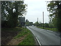
2
Towards the B1018
This footpath runs from the B1018 to Image
Image: © Glyn Baker
Taken: 5 May 2010
0.06 miles
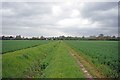
3
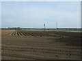
Furrowed field near Maldon
North of Langford Road.
Image: © JThomas
Taken: 27 Apr 2017
0.08 miles
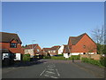
4
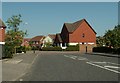
Modern housing near Heybridge
The road is called Doubleday Drive.
Image: © Robert Edwards
Taken: 7 May 2008
0.16 miles
5
Doubleday Drive, Heybridge
Doubleday Drive is part of a new housing development in Heybridge, Essex.
Image: © Malc McDonald
Taken: 20 Apr 2013
0.19 miles