IMAGES TAKEN NEAR TO
Honeycomb Close, CM8 3ZE
Introduction
This page details the photographs taken nearby to Honeycomb Close, CM8 3ZE by members of the Geograph project.
The Geograph project started in 2005 with the aim of publishing, organising and preserving representative images for every square kilometre of Great Britain, Ireland and the Isle of Man.

There are currently over 7.5m images from over14,400 individuals and you can help contribute to the project by visiting https://www.geograph.org.uk
Image Map
Images are licensed for reuse under creativecommons.org/licenses/by-sa/2.0
Notes
- Clicking on the map will re-center to the selected point.
- The higher the marker number, the further away the image location is from the centre of the postcode.
Image Listing (20 Images Found)
Images are licensed for reuse under creativecommons.org/licenses/by-sa/2.0
Image
Details
Distance
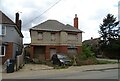
3
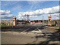
Entrance to the show house
On the new housing development at the junction with Western Road
Image: © Geographer
Taken: 5 Oct 2019
0.08 miles
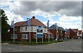
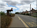
5

Motion Detector
At the entrance to the show house on the new housing development off Western Road
Image: © Geographer
Taken: 5 Oct 2019
0.08 miles
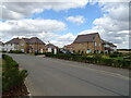
6
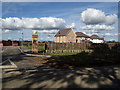
Sales Centre at new housing development
Off Western Road
Image: © Geographer
Taken: 5 Oct 2019
0.08 miles
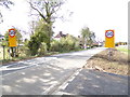
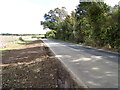
8
Path by fishing lake
The lake, a former gravel pit, is on the left.
Image: © Robin Webster
Taken: 15 Feb 2015
0.10 miles