IMAGES TAKEN NEAR TO
London Road, WITHAM, CM8 3HB
Introduction
This page details the photographs taken nearby to London Road, CM8 3HB by members of the Geograph project.
The Geograph project started in 2005 with the aim of publishing, organising and preserving representative images for every square kilometre of Great Britain, Ireland and the Isle of Man.

There are currently over 7.5m images from over14,400 individuals and you can help contribute to the project by visiting https://www.geograph.org.uk
Image Map
Images are licensed for reuse under creativecommons.org/licenses/by-sa/2.0
Notes
- Clicking on the map will re-center to the selected point.
- The higher the marker number, the further away the image location is from the centre of the postcode.
Image Listing (4 Images Found)
Images are licensed for reuse under creativecommons.org/licenses/by-sa/2.0
Image
Details
Distance
1

Kelvedon Park, Essex
This is the headquarters of The Essex Fire Authority. It is now called Kelvedon Park but was formerly named Durwards Hall.
Image: © Peter Stack
Taken: 29 Sep 2010
0.02 miles
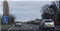
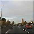
2
A12 Ipswich Road, Rivenhall End
At the Essex Fire & Rescue Headquarters
Image: © Geographer
Taken: 3 Feb 2016
0.15 miles
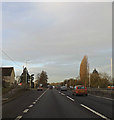
3
A12 London Road, Rivenhall End
Approaching Essex Fire & Rescue Headquarters
Image: © Geographer
Taken: 3 Feb 2016
0.18 miles