IMAGES TAKEN NEAR TO
Maldon Road, WITHAM, CM8 1HU
Introduction
This page details the photographs taken nearby to Maldon Road, CM8 1HU by members of the Geograph project.
The Geograph project started in 2005 with the aim of publishing, organising and preserving representative images for every square kilometre of Great Britain, Ireland and the Isle of Man.

There are currently over 7.5m images from over14,400 individuals and you can help contribute to the project by visiting https://www.geograph.org.uk
Image Map
Images are licensed for reuse under creativecommons.org/licenses/by-sa/2.0
Notes
- Clicking on the map will re-center to the selected point.
- The higher the marker number, the further away the image location is from the centre of the postcode.
Image Listing (6 Images Found)
Images are licensed for reuse under creativecommons.org/licenses/by-sa/2.0
Image
Details
Distance
1
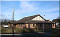
Church of Jesus Christ and The Latter Day Saints, Witham, Essex.
Image: © Peter Stack
Taken: 18 Jan 2009
0.06 miles
2
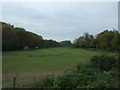
Blue Mills Hill
This road is called Blue Mills Hill after a mill that stands further along this road.
Image: © Robert Edwards
Taken: 27 Nov 2006
0.08 miles

4
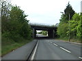
A12 bridge over Maldon Road, Witham
Looking south.
Image: © JThomas
Taken: 27 Apr 2017
0.15 miles
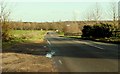
5
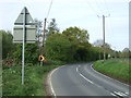
Sharp bend in Maldon Road, Witham
Looking west.
Image: © JThomas
Taken: 27 Apr 2017
0.16 miles