IMAGES TAKEN NEAR TO
Wordsworth Road, BRAINTREE, CM7 5SX
Introduction
This page details the photographs taken nearby to Wordsworth Road, CM7 5SX by members of the Geograph project.
The Geograph project started in 2005 with the aim of publishing, organising and preserving representative images for every square kilometre of Great Britain, Ireland and the Isle of Man.

There are currently over 7.5m images from over14,400 individuals and you can help contribute to the project by visiting https://www.geograph.org.uk
Image Map (Loading...)


Getting Data...Please wait
Leaflet Map data © OpenStreetMap
Images are licensed for reuse under creativecommons.org/licenses/by-sa/2.0
Notes
- Clicking on the map will re-center to the selected point.
- The higher the marker number, the further away the image location is from the centre of the postcode.
Image Listing (17 Images Found)
Images are licensed for reuse under creativecommons.org/licenses/by-sa/2.0
Image
Details
Distance
1
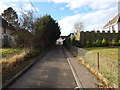
Wordsworth Road
A small dead end road off Church Lane.
Image: © Hamish Griffin
Taken: 25 Jan 2015
0.02 miles
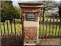
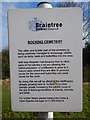
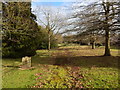
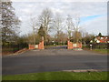
5
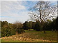
Bocking Cemetery
The northern part, the large tree is a Sycamore Tree.
Image: © Hamish Griffin
Taken: 25 Jan 2015
0.09 miles
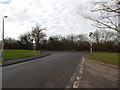
6
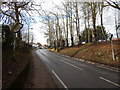
National speed limit applies
On Deanery Hill.
Image: © Hamish Griffin
Taken: 25 Jan 2015
0.15 miles
7
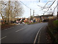
Church Lane/Deanery Hill junction
Straight on goes to Blcking Street, left goes to Shalford (the B1053 continues to the left, a turn off to stay on).
Image: © Hamish Griffin
Taken: 25 Jan 2015
0.16 miles
8
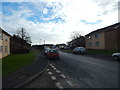
Churchill Road
The side road on the left is the smaller Deanery Hill.
Image: © Hamish Griffin
Taken: 25 Jan 2015
0.17 miles
9
Entrance to buildings
There is a for sale sign on the right which also appears on the 11.2010 Google Street View. This is probable an entrance to several houses, rather than a single one.
Image: © Hamish Griffin
Taken: 25 Jan 2015
0.17 miles
10
The end of Churchill Road
Coming out onto Deanery Hill, however the side road on the right is also called Deanery Hill.
Image: © Hamish Griffin
Taken: 25 Jan 2015
0.18 miles