IMAGES TAKEN NEAR TO
Winston Close, BRAINTREE, CM7 5RY
Introduction
This page details the photographs taken nearby to Winston Close, CM7 5RY by members of the Geograph project.
The Geograph project started in 2005 with the aim of publishing, organising and preserving representative images for every square kilometre of Great Britain, Ireland and the Isle of Man.

There are currently over 7.5m images from over14,400 individuals and you can help contribute to the project by visiting https://www.geograph.org.uk
Image Map
Images are licensed for reuse under creativecommons.org/licenses/by-sa/2.0
Notes
- Clicking on the map will re-center to the selected point.
- The higher the marker number, the further away the image location is from the centre of the postcode.
Image Listing (3 Images Found)
Images are licensed for reuse under creativecommons.org/licenses/by-sa/2.0
Image
Details
Distance
1

Houses from Deanery Hill
Along with an open area of grass.
Image: © Hamish Griffin
Taken: 25 Jan 2015
0.14 miles
2
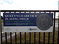
Queen Elizabeth II Playing Field sign
Deanery Hill, Blocking, Essex, CM7 5SS.
Image: © Hamish Griffin
Taken: 25 Jan 2015
0.20 miles
3

Car park entrance on Deanery Hill, Bocking
Image: © David Howard
Taken: 6 Jun 2013
0.20 miles